Moreton Bay, Australia: Environmental Literacy
Bill Dennison ·'Environmental Literacy' series
The seven environmental literacy points for Moreton Bay (Australia) are the following:
- Moreton Bay is a shallow productive embayment formed by large sand barrier islands on the east coast of Australia
- Extensive seagrass meadows support large populations of green sea turtles and dugong
- The Moreton Bay watershed has an extensive network of ephemeral streams connected to a series of river/estuaries prone to flooding
- Moreton Bay is vulnerable to gully erosion leading to sedimentation in a large mud patch which increases turbidity due to resuspension
- A rapidly developing watershed due to high population growth rates is affecting Moreton Bay
- Moreton Bay has extensive blooms of benthic cyanobacteria linked to land use changes, iron-rich humic runoff and human health impacts
- The Healthy Waterways campaign has stimulated monitoring, management and research
1. Moreton Bay is a shallow productive embayment formed by large sand barrier islands on the east coast of Australia
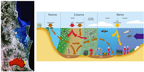
Moreton Bay is 8.4 m deep on average with extensive shallow sand and mud flats. There are abundant mangroves and seagrasses, some corals, and rich fisheries resources in Moreton Bay. Moreton, North Stradbroke and South Stradbroke Islands separate Moreton Bay from the Pacific Ocean.
2. Extensive seagrass meadows support large populations of green sea turtles and dugong
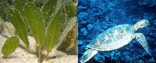
Moreton Bay seagrass meadows support upwards of 10,000 green sea turtles and almost a thousand dugongs. Moreton Bay is the southern most extent of tropical seagrasses and large populations of sea turtles and dugong on Australia's east coast.
3. The Moreton Bay watershed has an extensive network of ephemeral streams connected to a series of river/estuaries prone to flooding
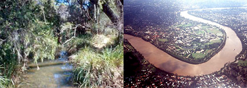
Most of the first and second order streams in the Moreton Bay catchments are ephemeral, flowing only following rain events. The rivers are estuaries for most of the year, with tidal exchange dominating the flow, but following significant periodic rain events, large freshwater flows pulse into Moreton Bay and cause flooding along the river flood plains.
4. Moreton Bay is vulnerable to gully erosion leading to sedimentation in a large mud patch which increases turbidity due to resuspension
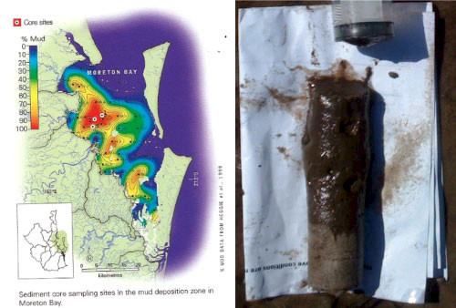
Gully erosion from streambanks during runoff events is the major source of eroded sediments in Seagrass declines due to increased turbidity have been documented in western Moreton Bay.
5. A rapidly developing watershed due to high population growth rates is affecting Moreton Bay
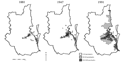
Brisbane and surrounding suburbs was the fourth fastest growing region in the world during the 1990s. Brisbane is the third largest city in Australia with continued population growth, largely via migration from within and beyond Australia, exceeding 2 million people.
6. Moreton Bay has extensive blooms of benthic cyanobacteria linked to land use changes, iron-rich humic runoff and human health impacts
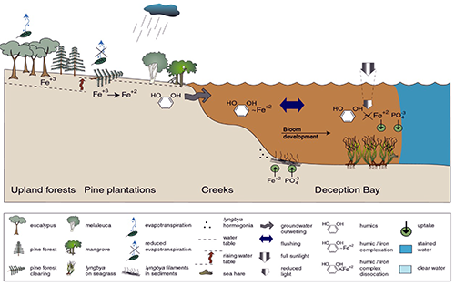
Blooms of Lyngbya majuscula (mermaid's hair or fireweed) regularly occur in northern Moreton Bay. Bloom initiation has been linked to land use changes that result in iron-rich humic runoff. Fisherman having contact with Lyngbya have reported skin rashes and respiratory difficulties. There is an ongoing Lyngbya monitoring and management program.
7. The Healthy Waterways campaign has stimulated monitoring, management and research
The Healthy Waterways program has an Ecosystem Health Monitoring Program which releases annual report cards, a regional management program involving all levels of government and an active ongoing research effort.

For further reading:
About the author
Bill Dennison

Dr. Bill Dennison is a Professor of Marine Science and Vice President for Science Application at the University of Maryland Center for Environmental Science.
Next Post > Scientists who made a difference: Celebrating effective science application
Comments
-
Vincent 11 years ago
I'm excited to find this page. I wanted to thank you
for ones time just for this fantastic read!! I definitely liked every part of it and I
have you book-marked to see new information on your blog.

