Sizing up the Mississippi River
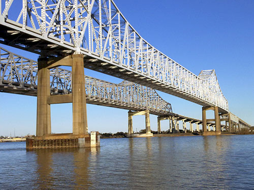
Bill Nuttle ·Last week, I attended a meeting of the Changing Course design competition in New Orleans. The Changing Course competition will stimulate innovative thinking about the future shape of coastal Louisiana, including possibly relocating the main channel of the Mississippi River below New Orleans - hence its name. The purpose of this meeting was to bring together the eight teams invited to enter the competition to review the issues at stake and answer questions about the competition. The meeting was held at the headquarters of the Port of New Orleans, which has a spectacular view of the Mississippi River.

The meeting included a day of panel discussions on the key issues that each team will have to address in re-designing the coast. These include supporting the needs of coastal communities, maintaining the region’s productive fisheries, allocating the freshwater and sediment carried by the river to rejuvenate ailing coastal wetlands, and providing reliable access for the navigation of sea-going vessels from the Gulf of Mexico to Baton Rouge, which is about 250 miles upstream as the river flows. Providing opportunities to bring together people with expertise on these separate topics is one of the motivations for holding the competition.
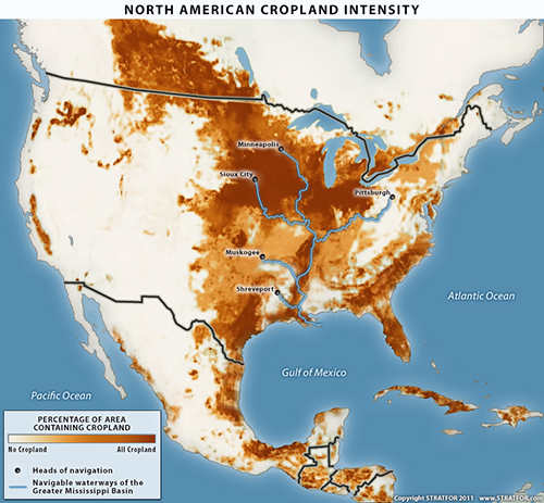
Navigation on the Mississippi serves as a vital transportation link within its vast basin and between the American Midwest and world markets. I learned that the Mississippi River basin contains more miles of navigable waterways than any other river basin in the world. Shipping material by water is around 10 to 30 times cheaper than overland transportation. Therefore, the waterways of the Mississippi River basin provide a tremendous advantage to the economy of the region. One speaker estimated that transportation on this river system affects in some way the goods reaching 62 percent of American consumers.

Maintaining navigation on the Mississippi River has global significance as well. The prairies of the American Midwest and adjacent Canadian provinces comprise the largest area of arable land on the globe. World-wide, only four or five regions support a comparable concentration of agriculture, but the agricultural area in the Mississippi River basin is by far the most productive. The export of the surplus production from this region to the rest of the world is a critical to supplying food to a growing world population, and most of this food moves down the Mississippi and through New Orleans on its way to ports around the world.
This meeting was the first opportunity for me and many other scientists and engineers who have been involved primarily in the restoration of Louisiana’s coastal resources to work with people from the navigation industry. The broad channel of the Mississippi seemed to grow smaller as my comprehension grew of the magnitude and importance of the activities this river supports.

