The Los Angeles River: Geography, vistas and restoration
Bill Dennison · | Science Communication | 1 commentsPart 1. Geography, hydrology (and floods), and water cycle
This is Part 1 of a three part blog series on the Los Angeles River, based on a reconnaissance of the Los Angeles River conducted by Bill Dennison and Simon Costanzo from IAN, organized by the Council for Watershed Health on 1-2 April 2014. This blog focuses on the geography, hydrology (including floods), and water cycle for the Los Angeles River.
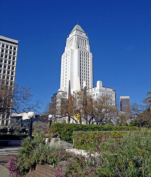
Simon Costanzo and I were given a tour of the Los Angeles River by our hosts at the Council for Watershed Health (CWH). The Council for Watershed Health is headed by Nancy Steele, and she orchestrated a very nice crash course on the history, geography, hydrology and restoration of the Los Angeles River. Mike Antos, a geographer/hydrologist with CWH was a fontain of information. We studied maps, met a diversity of people, were given various publications to read and, most importantly, drove around the watershed and made many stops to view the river, watershed and the numerous restoration projects.
What was particularly satisfying about this exposure to the LA River was the basic understanding that we gained about the history of the City of Los Angeles, the overall geography of the region and the creative approaches that people are applying to the restoration of this highly modified river. I am most appreciative of the opportunity to gain a broad geographical understanding of the Los Angeles area, which put into perspective my numerous previous visits where I learned to navigate the highways, but without an understanding of the complex history of water flows which affected the establishment and growth of this megacity.

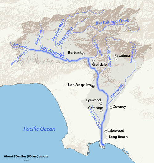
Geography: The Los Angeles River is about fifty miles long, and the entire length has trapezoidal shaped or rectangular shaped concrete walls, and most of it has a concrete bottom as well. The two regions with a 'soft' bottom (natural substrate instead of concrete) are the Glendale Narrows region where there is 'rising groundwater' and the mouth as the river enters the Pacific Ocean in Long Beach. The 'rising groundwater' phenomenon is due to artisan flow of groundwater from under the river, percolating to the surface. In fact, this is why Los Angeles was originally settled by native Americans followed by the first European settlers in the region of what is current day downtown Los Angeles. The availability of freshwater in this arid region was much more important than access to the sea or other factors.
There are two ranges of low mountains that bound the Los Angeles River. To the north are the San Gabriel Mountains, which are largely unpopulated and managed by the Angeles National Forest by the U.S. Forest Service. There is also a smaller mountain range along the coast, the Santa Monica Mountains. The region directly between these two maintain ranges is the San Fernando Valley (which is, like, known as, like, the 'Valley', with the, like, notorious 'Valley Girls'). The current Los Angeles River has its origin at the top of the San Fernando Valley, and travels southeast, nestled up against the Santa Monica Mountains until it makes a bend through the Glendale Narrows and then runs due south to Long Beach and into the Pacific Ocean.
The original course of the Los Angeles River is very different from the current flow path. When viewing a map of the river, it is obvious that significant straightening has occurred, particularly in the north/south lower section of the river. What is less obvious is the modification of adjacent rivers and watersheds. The Los Angeles River flow converged with the San Gabriel River flow during floods associated with winter rains in this Mediterranean climate (hot dry summers and cool winter rains). This region of convergence led to an alluvial plain of sediments eroded from the San Gabriel Mountains and marshy vegetation. It was difficult to traverse this region during wet season rains and historic floods destroyed property and many lives were lost. The factoid that we were told was that more people in Los Angeles have died due to floods than earthquakes since 1900.

Flood control: It was the danger associated with floods that stimulated the citizens in this region to obtain funding and contract the U.S. Army Corps of Engineers to channelize the river. The channelization of the Los Angeles River was one of the great engineering works initiated in the Great Depression (1930s). The design was for the least resistance to water flow, resulting in a very flat and smooth bottom and smooth, shallow sloping sides with continuous levees to prevent overtopping. Not only is the mainstem of the entire fifty mile long river channelized, but many of the side channels are also channelized.
In addition to channelization, there are two other flood mitigation public works that have occurred. One is the construction of a series of small dams in the tributaries of the Los Angeles River that originate in the San Gabriel Mountains. The other flood mitigation strategy is to create a series of 'spreading grounds' in which stormwater is diverted into broad undeveloped basins to allow percolation into groundwater. The dams, spreading grounds and channelized river have been largely successful in preventing flood damage and loss of life, but there are several factors operating to endanger that track record.
One factor is the increasingly impervious watershed due to the unrelenting population growth in Southern California. This has created a vast 'urban seal' of impervious surfaces (e.g., roofs, roads and parking lots) which means that water runs off more rapidly into streams and rivers. A quantification of the impact of impervious surfaces is a graph of the percent of precipitation as runoff since 1928 when the percent runoff was less than 5%, and steadily rising to the present day with over 40% runoff due to more impervious surfaces. Another factor is climate change which means that more extreme weather events occur, so sequences of prolonged drought punctuated by intense rainfall can accentuate spiked runoff events. The specter of a major flood in Los Angeles is a powerful motivator to maintain a channelized river but also to create more infiltration opportunities.

Water cycle: Perhaps the most important event in the historical development of Los Angeles was the creation of the Los Angeles aqueduct to obtain drinking water from beyond the Los Angeles River watershed. The decoupling of local water availability from the rivers and groundwater of Los Angeles which began in 1913, the subject of various books and movies (e.g., Chinatown), allowed Los Angeles population to grow beyond what was sustainable, based on local water availability. Two additional massive engineering works have been constructed subsequent to the Los Angeles Aqueduct, the Colorado River Aqueduct (1939) to the east and the California Aqueduct (1997) to the north which transports water from the Sacramento and San Joaquin Rivers near the head of San Francisco Bay to Los Angeles. These three major aqueducts allow Angelenos to access water with its origins from as far away as Wyoming!
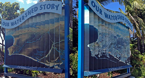
We learned about the importance of surface watersheds, ground watersheds and sewersheds in Southern California. The engineering of water supply and water treatment means that the water obtained from distant sources, used, treated and released into the Los Angeles River, diverted into groundwater, extracted and reused, treated and released again can have a very circuitous route before reaching the sea, if indeed if ever does flow into the ocean. The water cycle is largely managed by the Metropolitan Water District.

The next blog post in this series will focus on the Los Angeles River features that can be observed from various vantage points.
About the author
Bill Dennison

Dr. Bill Dennison is a Professor of Marine Science and Vice President for Science Application at the University of Maryland Center for Environmental Science.
Next Post > Developing a Mississippi River report card: Lower Mississippi workshop in Memphis
Comments
-
Steve Fairchild 9 years ago
Hi, I used to live next to the Los Angeles river north of Long Beach. It was my playground for many years.
The river then was contained by rock covered channeling. A great place to fish and hunt. There were forests to the north of Wardlow road that sheltered foxes, rabbits, coyote,s and lots of creatures. Sometime then the Army core, I think, started from the harbor and began concreting up the river. They got as far as about a mile north of Wardlow road when winter set-in and work stopped. A few weeks later a heavy rain period filled the un-covered river bed, edge to edge, and as usual there were heavy current “hay-stacks in the center flow.As we watched we noticed that strange new, high, wide waves started to form. Then giant blocks of concrete rose from the river one after another as the new concrete river bed folded and broke for about two miles. Later that summer all this had to be removed before they could continue up-river.
I believe this was about 1953 or '54. Do you have, or know of, any records of this thing, or the the date that this happened?
Thank you in advance,
Steve Fairchild