The Los Angeles River: Geography, vistas and restoration
Bill Dennison · | Science Communication |Part 2. Viewing river features from different vantage points
This is Part 2 of a three part blog series on the Los Angeles River, based on a reconnaissance of the Los Angeles River conducted by Bill Dennison and Simon Costanzo from IAN, organized by the Council for Watershed Health on 1-2 April 2014. This blog focuses on the river features that could be viewed from different vantage points alongside the river or from elevated vistas.

The Los Angeles River and many of its side channels form transportation corridors. Highways, train lines, and power lines parallel and often cross over the river. It is the presence of these various transportation corridor features, combined with the levees that serve to reduce the accessibility of the river by the public. More recently, bikeways have been created, paralleling the river and in one case, actually along the river bottom (except during flow events).
The Los Angeles River is familiar to many people around the world, due to the use of the dry river bottom and various bridges as a backdrop to various television and movie scenes. This proximity to Hollywood and limited open space in the metropolitan Los Angeles region has meant that the river has been a prime location for filming. Thus, many people have already formed an opinion of the Los Angeles River, filmed during low flow conditions and characterized as a large sewer.
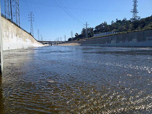
Vantage point - Confluence of Los Angeles River and the Arroyo Seco: This visit to the real heart of historic Los Angeles was somewhat surreal. We walked down a long sloping driveway underneath an overpass to the water's edge, passing by a series of homeless people's 'residences'. These 'residences' underneath an overpass and at the top of the river levee included beds on frames and loud music even came from one of the more permanent, walled in 'residences'. The Los Angeles River had flowing water completely covering the bottom of the concrete channel. We saw swarming swallows feeding on insects over the river's surface. There were algal filaments attached to the channel, attesting to the high nutrient river water. The huge levee walls were testament to the infrequent but very high flow events that occur in this region.

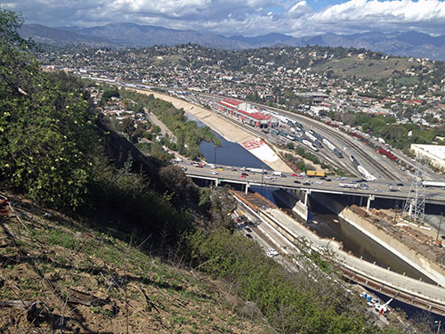
Vantage points - Elysian Park and Dodger Stadium: Elysian Park is at the eastern most Santa Monica Mountain range, just at the bend of the Los Angeles River, where it turns from flowing southeastly to due south. We had a gorgeous clear day and we could see the confluence of the LA River and Arroyo Secu underneath us and all the way to Long Beach, the hills of Palos Verdes and out to the Channel Islands. The notch in the mountains that opened up to Pasadena (where our hotel was located) was clearly visible. We could also look down on a small reservoir in Elysian Park which was covered by black plastic balls to reduce evaporation.

I was surprised to see so many active rail lines along the river. The freight rail traffic that connects the distribution of containers unloaded at Long Beach to the rest of the country is matched by an increasing number of light rail passenger trains. The expansion of public transportation in the Los Angeles area was unexpected, with buses and light rail providing public transportation in this city built around the automobile. From Elysian Park, we could see Dodger Stadium on the next hill over, so we made our way to this vista as well. Baseball season had begun, but the Dodgers were not playing at home so we were able to find our way into their vast impervious parking lot to view the city from a slightly different vantage point.
From Dodger Stadium, we could see the railroad yards where trucks are used to ferry containers to and from the port. We could also see vast areas of rooftop impervious surfaces. We asked about the use of green roofs - planting vegetation on rooftops to absorb nutrients, provide insulation and reduce stormwater runoff, which is a practice increasingly used in the Chesapeake Bay. The response was that green roofs do not work in Southern California due to the extremely arid conditions. Green roofs would consume too much precious water.
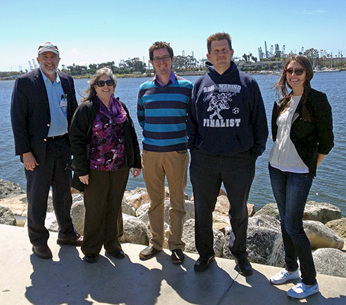
Vantage points - Long Beach: In order to view the mouth of the Los Angeles River, we drove from downtown Los Angeles to Long Beach alongside the river, crossing it several times. There were many trucks transporting containers and other cargo between the port and railyards to load onto trains. We even saw one truck with a 24 wheel trailer for transporting heavy goods. The river corridor had power lines and high levees, with occasional spillways built into the levee near the mouth. In Long Beach, we found two nice vistas, one in San Pedro and one at the Aquarium of the Pacific. The San Pedro side of the harbor had commercial purse seining fishing fleet and a series of tour boats and waterside restaurants. The decommissioned U.S.S. Iowa is moored in San Pedro as a tourist attraction. I recall sailing by the Iowa aboard the R/V Westward in St. Thomas, U.S. Virgin Islands in the late 1980s. There was a nice tall ship, appropriately named the Los Angeles, also moored in San Pedro. Interestingly, the map of the city limits of Los Angeles has a narrow corridor to connect it to the San Pedro side of the harbor, created to give the city access to the port.

We drove over some scary high bridges to the Aquarium of the Pacific literally right on the Los Angeles River mouth, which is in the city of Long Beach. My old friend Jerry Schubel is Director of the Aquarium of the Pacific and has transformed it from a money-losing proposition to an active money-making operation. Indeed, there were dozens of school children and various tourists gathered near the entrance when we were there. We could see the fencing and piles of used tires that were being constructed for the upcoming Grand Prix automobile race that was scheduled for the following weekend on the city streets of Long Beach. Although we did not have time for a visit inside the Aquarium, I enjoyed the fixed sign next to the LEEDS Platinum Aquarium workshop building that had two versions of the same scene of the lower Los Angeles River: a historical view and approached which transformed into a modern view as you walked by the sign.
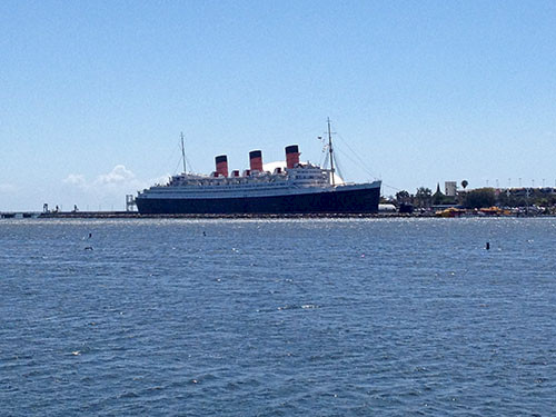
We could see the gigantic Queen Mary, the former ocean liner, moored across the river where it serves as a floating hotel, restaurant and tourist attraction now. We saw people fishing from the river piers and the signage that warned them about consumption advisories. Even though there was a cool breeze, we encountered several Canadian tourists wearing summer clothing, enjoying the relative warmth.

The next blog post in this series will focus on the efforts to restore the Los Angeles River, some of the organizations involved and my impressions of the river based on our reconnaissance.
About the author
Bill Dennison

Dr. Bill Dennison is a Professor of Marine Science and Vice President for Science Application at the University of Maryland Center for Environmental Science.