

The Storm a’Coming
Joe Edgerton ·It was a gloomy Friday on Oct. 29th when the staff at the IAN offices began taking and trading photos with each other of rising floodwater on both sides of the Bay in Annapolis and the Eastern Shore.
This tidal flooding event, according to the National Weather Service, was comparable to the flooding from Hurricane Isabel, at least in certain areas.1 The large size of the tidal flood was caused by a high tide mixed together with lots of wind and rain; the wind was forcing water close to the shoreline and this seems to be a key factor for the flooding.2,3 Knowing that the flood would only continue into the evening, staff at IAN took the chance to document the conditions of what was happening on the ground.
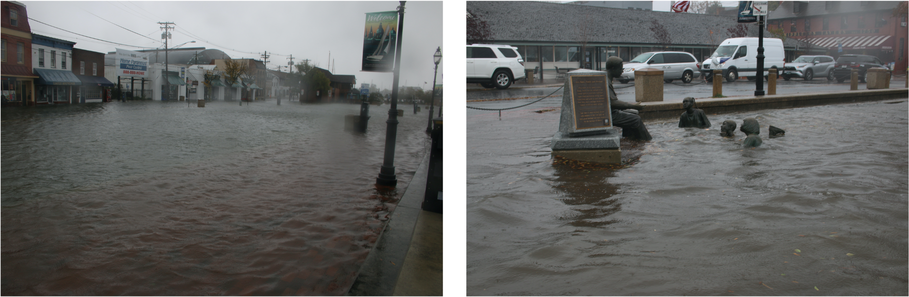
After some coordination, and in the midst of heavy wind, several of the science communicators geared up to document the event around the Annapolis, Cambridge, and Centreville areas. Here is a sample of their photos:
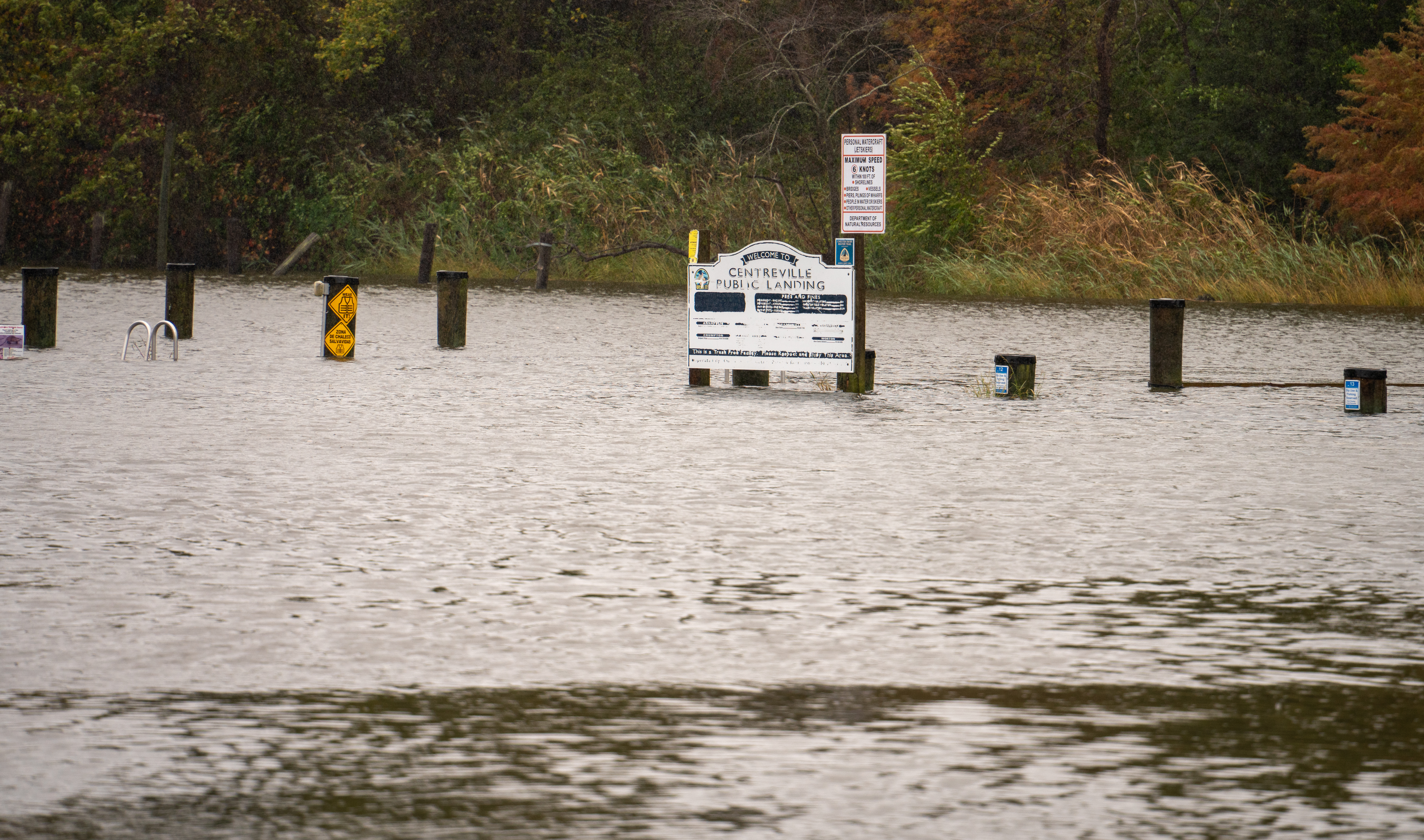

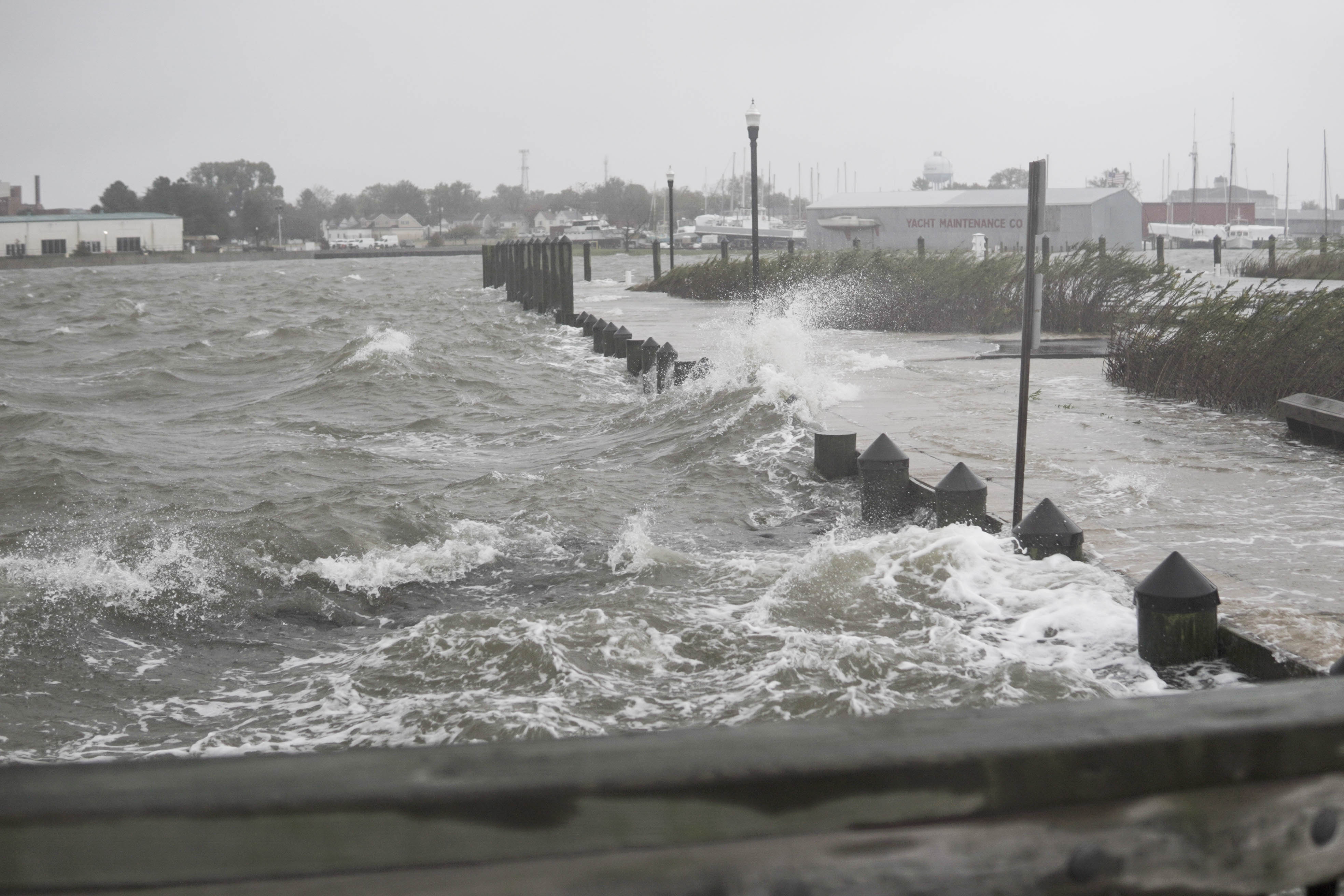
The mid-Atlantic region received around 1–2 inches of rain, and, at its peak, the flood stage level in Annapolis was 4.90 feet, the fourth-highest level on record for Annapolis; for other areas around the Bay, the flood stage level was even higher.2,1
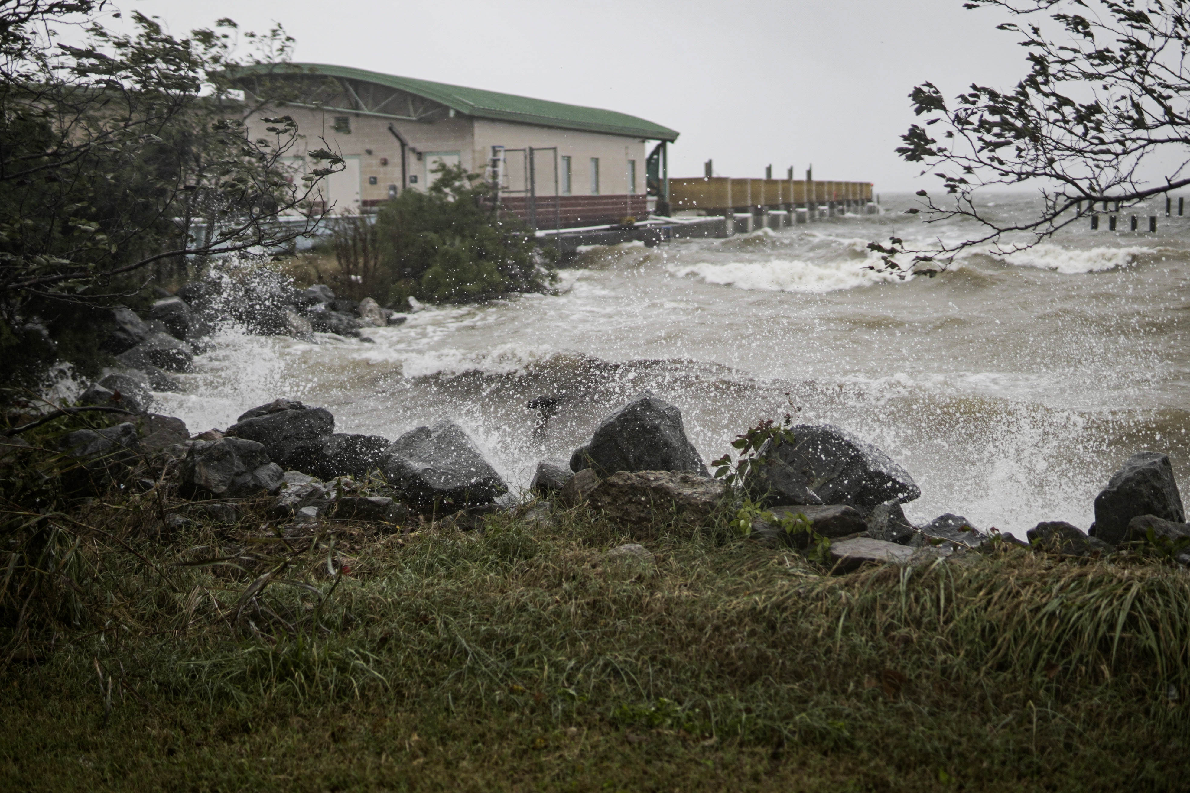
Early on Friday, well before the flooding would reach its peak, my coworker and I took a trip to the edge of the docks outside the IAN Cambridge office. Once we arrived I almost wanted to lean my back into the wind so I could be held up without effort.
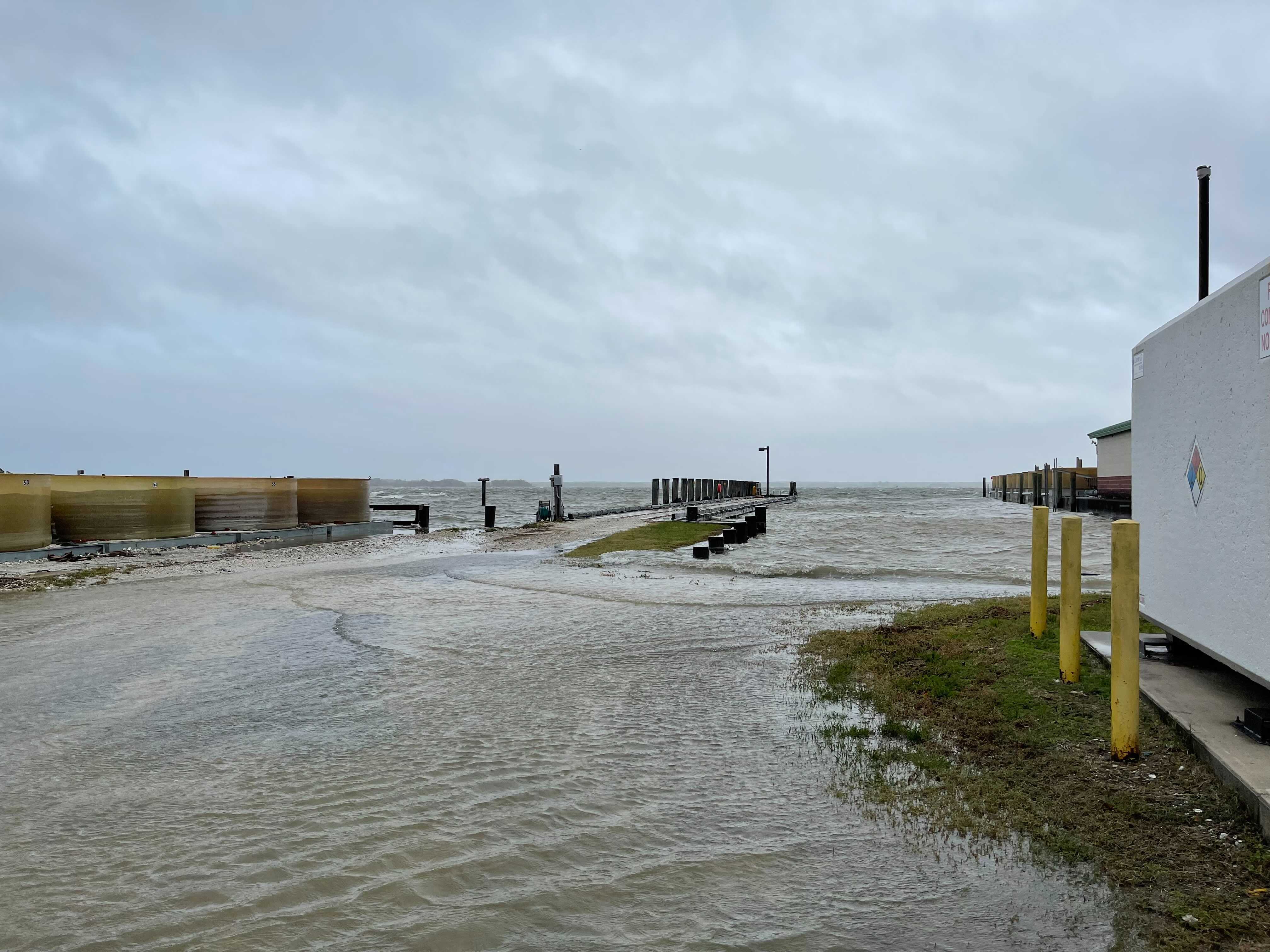
Being as safe as we could, it was incredible to witness firsthand the abrupt change in weather that accompanied this tidal flooding event. Photo by Nathan Miller.
Thankfully, the storm and flooding had died down on Saturday, and at the end of the day no one had reported a death from injuries related to the flooding.2 Businesses in Annapolis did incur damage from the floodwater that rose over the sandbags, though some business owners thought the damage was not as bad as damages from Hurricane Isabel in 2003.2
As someone who hasn’t experienced flooding or storm events like this one, it was both humbling and powerful to see how unruly the elements can become.
References
- NWSChat Administration Team. (2021). NOAA's National Weather Service NWSChat. Retrieved from https://nwschat.weather.gov/p.php?pid=202110301441-KLWX-NOUS41-PNSLWX
- Kasakove, S. (2021, October 30). High Tidal Surges Bring Floods to the Mid-Atlantic Region. New York Times. Retrieved from https://www.nytimes.com/2021/10/30/us/flooding-new-jersey-maryland-virginia.html
- Condon, C., Mann, A., & Louis B.J. (2021, October 29). Maryland weather: Serious coastal flooding continues across Baltimore region, Hogan issues state of emergency. Baltimore Sun. Retrieved from https://www.baltimoresun.com/weather/bs-md-coastal-flooding-maryland-forecast-20211028-g3pmoudzxbagrf4g6zrk4d5nne-story.html
About the author
Joe Edgerton

Joseph Edgerton is an Assistant Science Communicator for the Integration and Application Network (IAN) within the University of Maryland Center for Environmental Science. Joe graduated from Oregon State University with a B.S. in biology in 2019. After undergrad, he became increasingly interested in data visualization and communication. Formally an IAN intern, he continues to assist IAN team members with designing science communication products, engaging stakeholders, and working with data. Joe enjoys travelling to nature parks, working with all things R code, and having “decent” hacky sack skills.