

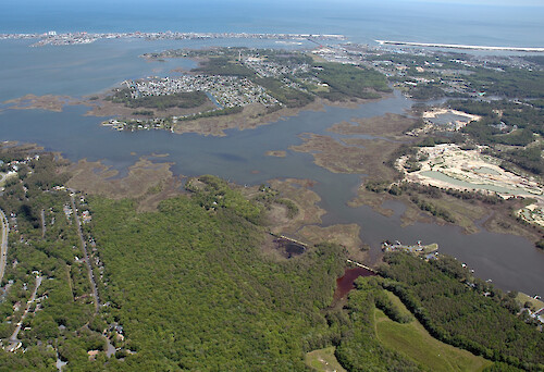
Herring and Turville Creeks
Aerial view of Herring (background) and Turville (foreground) Creeks. The Riddle Farm development is visible on the right. Cape Isle of Wight and Assateague and Fenwick Islands are in the background
Maryland Coastal Bays Herring Turville Creek Isle of Wight Riddle Farm Assateague Fenwick| Property | Value |
|---|---|
| Author(s) | Jane Thomas |
| Author Company | Integration and Application Network |
| Date Created | 2006-05-22 |
| Album | Ecosystems > Coastal/Marine |
| Type | Photo |
| Dimensions | 2814 x 1926 |
| Filesize | 4.2 MB |
| Number of Downloads | 319 |
| Filetype(s) | JPG |
| License | Attribution-ShareAlike 4.0 International (CC BY-SA 4.0) |
| Required Attribution | Jane Thomas, Integration and Application Network (ian.umces.edu/media-library) |