

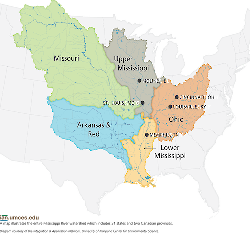
Mississippi River Watershed Map
The Mississippi River Watershed includes six sub-basins and stretches across 31 states and two Canadian provinces. Each sub-basin has its own indicators and results that will all be used in creating the report card.
diagram mississippi river watershed map states cities| Property | Value |
|---|---|
| Author(s) | Jane Thomas |
| Author Company | Integration and Application Network |
| Date Created | 1969-12-31 |
| Album | Ecosystems > Maps |
| Type | Graphic |
| Publication | Lower Mississippi River Basin report card workshop newsletter |
| Project(s) | EcoCheck |
| Dimensions | 943 x 882 |
| Filesize | 284.1 kB |
| Number of Downloads | 423 |
| Filetype(s) | PNG |
| License | Attribution-ShareAlike 4.0 International (CC BY-SA 4.0) |
| Required Attribution | Jane Thomas, Integration and Application Network (ian.umces.edu/media-library) |