

Ohio River Basin Land Use
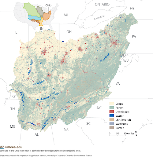
A map shows that land use in the Ohio River Basin is dominated by developed, forested and cropland areas. Diagram from "Ohio River Basin Report Card" (p.1)- /enewsletter/2014/february/ohio-river-basin-report-card-workshop-newsletter/
diagram map Ohio river basin land use developed forested cropland Mississippi| Property | Value |
|---|---|
| Author(s) | Jane Thomas |
| Author Company | Integration and Application Network |
| Date Created | 2014-06-10 |
| Album | Ecosystems > Maps |
| Type | Graphic |
| Project(s) | EcoCheck |
| Dimensions | 1000 x 1028 |
| Filesize | 945.9 kB |
| Number of Downloads | 370 |
| Filetype(s) | PNG |
| License | Attribution-ShareAlike 4.0 International (CC BY-SA 4.0) |
| Required Attribution | Jane Thomas, Integration and Application Network (ian.umces.edu/media-library) |