

South Florida current trajectories
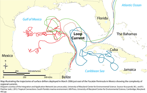
Map of the results of a March 2006 study. Each color is a surface drifter which was deployed just east of the Yucatan Peninsula in Mexico. The general currents of the area are displayed on this map.
diagram illustration current florida peninsula belize bahamas cuba loop surface drifter| Property | Value |
|---|---|
| Author(s) | Kris Beckert |
| Author Company | Integration and Application Network |
| Date Created | 2012-01-01 |
| Album | Processes > Inputs/flows |
| Type | Photo |
| Publication | Tropical Connections: South Florida's marine environment |
| Project(s) | South Florida Ecosystem Synthesis |
| Dimensions | 1000 x 634 |
| Filesize | 180.6 kB |
| Number of Downloads | 361 |
| Filetype(s) | PNG |
| License | Attribution-ShareAlike 4.0 International (CC BY-SA 4.0) |
| Required Attribution | Kris Beckert, Integration and Application Network (ian.umces.edu/media-library) |