

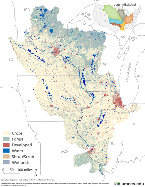
Upper Mississippi River River sub-basin land use
This map depicts land use in the Upper Mississippi River River sub-basin, one of the five major sub-basins of the Mississippi River.
diagram Upper Mississippi crops forest developed water shrub scrub wetlands barren Midwest river basin| Property | Value |
|---|---|
| Author(s) | Jane Thomas |
| Author Company | Integration and Application Network |
| Date Created | 2013-11-22 |
| Album | Ecosystems > Other |
| Type | Graphic |
| Publication | Upper Mississippi River Sub-Basin report card workshop newsletter |
| Project(s) | Development of the Mississippi River Watershed Report Card |
| Dimensions | 1000 x 1289 |
| Filesize | 1.0 MB |
| Number of Downloads | 414 |
| Filetype(s) | PNG |
| License | Attribution-ShareAlike 4.0 International (CC BY-SA 4.0) |
| Required Attribution | Jane Thomas, Integration and Application Network (ian.umces.edu/media-library) |