Developing a Chesapeake Bay Report Card
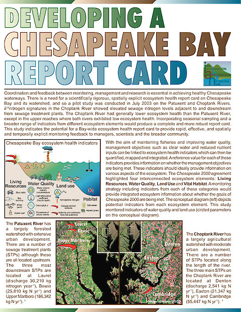
This newsletter details the importance of developing a scientifically rigorous, spatially explicit ecosystem health report card on Chesapeake Bay and its watershed to facilitate coordination and feedback between monitoring, management and research. A pilot study was conducted in July 2003 on the Patuxent and Choptank Rivers using a novel stable isotope technique (see "Assessing Nutrient Sources" newsletter below) together with more traditional water quality monitoring techniques. Spatial statistical analysis and mapping was conducted and an Ecosystem Health Index (EHI) developed. From these, report card values (A to F) were determined for various reporting regions within the rivers and compared to a region near the mouth of Chesapeake Bay. A spatially explicit index of ecosystem health such as this is a useful monitoring tool which can help focus management and research efforts by providing rapid, effective and timely feedback on the health of Chesapeake Bay.
Keywords: