Resiliency and water resources management: Water supply in a changing climate
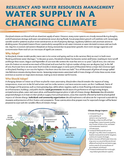
Maryland citizens are blessed with an abundant supply of water. However, many water systems are already stressed during droughts, and infrastructure damage and water contamination occurs during floods. Future population growth will combine with increasingly variable weather patterns to place more communities at risk of property damage, regulatory liabilities and uncertain access to drinking water. Maryland’s Eastern Shore is particularly susceptible to salt water intrusion as water demand increases and sea levels rise. Aquifers in central and western Maryland are being stressed due to population growth; short-term storage capacities and contamination from road salt are two issues of significant concern. A changing climate will mean we all have to plan for more uncertainty. Marylanders should consider the impacts of rising temperatures, more rain in the fall and winter and less in the summer, and more extreme events, on their livelihoods. Some of the changes will be positive, such as more growing days, while others negative, such as more flooding and associated impacts on infrastructure, buildings, and public health.
Keywords: