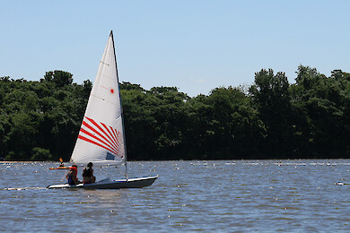
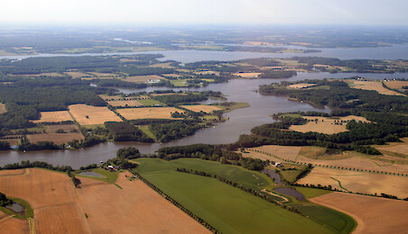
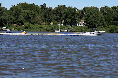
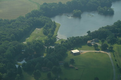
• All
  • People
  • Publications
  • Media Library
  • Blog Posts
  • Enewsletter Articles
  • All results

    155 results for "chester river":

    • Chester River
      Chester River ... Looking east down the Chester River. ... Chester River, Chesapeake Bay, aerial ... Ben Longstaff...
    • West Fork
      West Fork ... West Fork of Langford Creek, a tributary of the Chester River ... Chesapeake Bay river, farms, agriculture ... Jane Thomas...
    • Chester River
      Chester River ... The Chester River winds its way to the Chesapeake Bay ... shoreline river, Chesapeake Bay, agriculture ... Jane Thomas...
    • Chestertown
      Chestertown ... Chestertown on the Chester River ... shoreline river, Chesapeake Bay, agriculture ... Jane Thomas...
    • Chestertown
      Chestertown ... Chestertown on the Chester River. The Route 213 bridge is in the background. ... shoreline, farms, fields, Chesapeake Bay, agriculture ... Jane Thoma...
    • Chestertown
      Chestertown ... Chestertown on the Chester River. The Route 213 bridge is in the background. ... shoreline, farms, fields, Chesapeake Bay, agriculture ... Jane Thoma...
    • Chester River
      Chester River ... Looking across the Chester River towards the West Fork of Langford Creek (background, left) and the East Ford (background, right). ... Chesapeake Bay...
    • Chester River
      Chester River ... Looking southwest towards the mouth of the Chester River ... Chesapeake Bay, Chester River, agriculture, farms, shoreline ... Jane Thomas...
    • Chester River
      Chester River ... Looking north across a bend in the Chester River ... Chesapeake Bay, Chester River, agriculture, farms, shoreline ... Jane Thomas...
    • Chester River
      Chester River ... Saltmarsh on the Morgan Creek, a tributary of the Chester River ... shoreline, farms, fields, Chesapeake Bay, agriculture, marshes ... Jane Thomas...
    • Chester River
      Chester River ... Looking towards the mouth of the Chester River. Kingstown (across the river from Chestertown) is on the left. ... Chesapeake Bay, Chester River, agriculture, farms...
    • Chester River
      Chester River ... Looking towards the mouth of the Chester River. Southeast Creek is on the left (foreground). ... Chesapeake Bay, Chester River, agriculture, farms, shoreline ... J...
    • Chester River
      Chester River ... Looking towards the mouth of the Chester River. Southeast Creek is on the left (foreground). ... Chesapeake Bay, Chester River, agriculture, farms, shoreline ... J...
    • Chester River
      Chester River ... Looking across a bend in the Chester River. Chestertown is in the background. ... Chesapeake Bay, Chester River, agriculture, farms, shoreline ... Jane Thomas...
    • Chester River
      Chester River ... Looking towards the mouth of the Chester River. Southeast Creek is in the foreground ... Chesapeake Bay, Chester River, agriculture, farms, shoreline ... Jane Thom...
    • Chester River
      Chester River ... Looking across the Chester River. Southeast Creek is in the foreground, and Chestertown is in the background ... Chesapeake Bay, Chester River, agric...
    • Chestertown
      Chestertown ... Chestertown on the Chester River, with the Route 213 bridge. ... Chesapeake Bay, Chester River, agriculture, farms, shoreline ... Jane Thomas...
    • Kent Island and the Chester River
      Kent Island and the Chester River ... Looking north from the north shore of Kent Island over the mouth of the Chester River. Castle Marina is in the foreground. ... Chesapeake Bay, aerial, agriculture, farms, Chester River, shoreline ... Ja...
    • Kent Narrows
      .... The Kent Island bridge and Bay Bridge are visible. Eastern Bay is on the southern (left) side of Kent Narrows; the Chester River is on the northern (right) side. ... Chesapeake Bay, aerial, agriculture, farms, Chester River, shoreline ... Jane T...
    • Kent Narrows
      ...s to Kent Island. The Kent Island bridge is visible. Eastern Bay is on the southern (left) side of Kent Narrows; the Chester River is on the northern (right) side. ... Chesapeake Bay, aerial, agriculture, farms, Chester River, shoreline ... Jane T...
    • Quaker Neck
      Quaker Neck ... Looking across Quaker Neck to Langford Creek, a tributary of the Chester River ... Chesapeake Bay, aerial, agriculture, farms, Chester River, shoreline ... Jane Thomas...
    • Eastern Neck
      Eastern Neck ... Looking across Eastern Neck which separates the Chester River (foreground) from the mainstem of the Chesapeake Bay (background). Grays Inn Creek is at the far right. ... Chesapea...
    • Eastern Neck National Wildlife Refuge
      ...ldlife Refuge. Kent Island and the Bay Bridge are in the background. ... Chesapeake Bay, aerial, agriculture, farms, Chester River, shoreline ... Jane Thomas...
    • Quaker Neck
      ...ck, which separates the West Fork of the Langford Creek (background) from the East Fork (mid-ground). Comegys Bight (Chester River) is in the foreground. ... Chesapeake Bay, aerial, agriculture, farms, Chester River, shoreline ... Jane Thomas...
    • Quaker Neck
      ...ord Creek (background, left) from the East Fork (background, right). ... Chesapeake Bay, aerial, agriculture, farms, Chester River, shoreline ... Jane Thomas...