Development of an Ecosystem Health Report Card for Laguna de Bay, Philippines
Vanessa Vargas-Nguyen ·This summer, I was given the great opportunity to be involved in the development of the first IAN report card in my home country. Last June 1-3 2015, Dave Nemazie and Simon Costanzo joined me in the Philippines to help facilitate the Second Workshop on the Development of Ecosystem Health Report Card for Laguna de Bay. This project is jointly implemented by the Partnerships in Environmental Management for the Seas of East Asia Resource Facility (PRF) and the Laguna Lake Development Authority (LLDA), under the UNEP/GEF Project on Global Foundations for Reducing Nutrient Enrichment and Oxygen Depletion from Land-based Pollution in Support of Global Nutrient Cycle [pdf]. IAN-UMCES, through Dave and Simon, has been involved with this endeavor since the first workshop last December 2013.
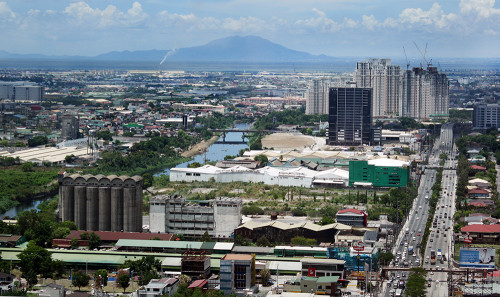
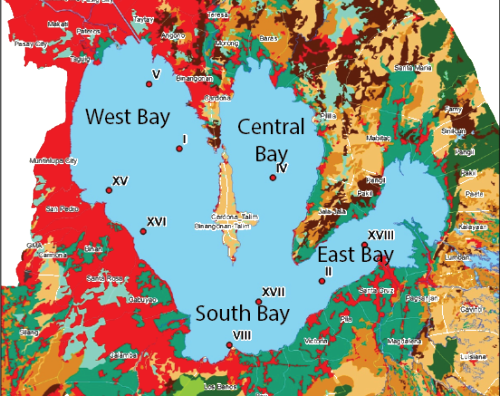
Laguna de Bay is the largest fresh water lake in the Philippines, and the third largest in South East Asia. Prior to this, I had no in-depth knowledge of Laguna de Bay. I even mistakenly thought that its direct translation is "Lake of Laguna". However, Laguna de Bay actually means "Lake of [the town of] Bay" for the lakeshore town of Bay (pronounced as "Bä'ï"), the former capital of Laguna province. The lake features three distinct bays, the West Bay, Central Bay and East Bay that diverges to the South (South Bay). The lake's watershed includes the whole provinces of Laguna and Rizal, and some towns in Batangas, Cavite, Quezon and cities in Metro Manila. The West Bay watershed, which includes parts of Metro Manila, is the most populated and heavily developed while the East Bay is on the less populated side of the lake. Laguna de Bay is a multi-use water resource, it is a source of fish, irrigation water, livestock animal feeds, and domestic water, among others. It is also used for industrial cooling, hydroelectric power generation, transportation, and recreation.
![Laguna de Bay Map and Quick Facts. Map from Santos-Borja and Nepomuceno, 2006 [pdf], credit: Vanessa Vargas Laguna de Bay Map and Quick Facts](/site/assets/files/2477/quick-facts-01-copy-500x341.png)
Dave and Simon both arrived the night of May 31st, Dave straight from the US, while Simon from another IAN trip in Cambodia. On the morning of June 1st, the three of us went with Ms. Adelina Santos-Borja, Division Chief III, International Linkages and Research Development Division of LLDA, for a quick tour of the West Bay of Laguna de Bay. We were only able to drive along part of the Pasig River (which connects Manila Bay and Laguna de Bay) and the Manggahan Floodway (diverts Metro Manila’s flood water to Laguna de Bay). We saw how polluted and eutrophic Pasig River is, but even so, it is still used for navigation and still supports livelihood. We also stopped to have some drinks at a famous restaurant with a view of Metro Manila, and part of the West Bay watershed.
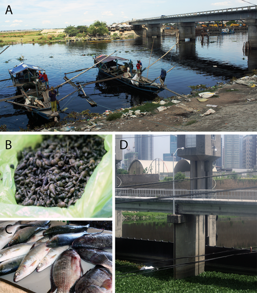
After a brief meeting with Mr. Stephen Adrian Ross, Executive Director of PRF, at their headquarters in Quezon City, we headed to the workshop location at the Holiday Inn in Clark, Pampanga. During the surprisingly traffic-free 1.5-hour drive, Simon wasted no time in engaging the three (of the four) external experts who were with us. I was reunited with my former professor from the University of the Philippines, Marine Science Institute (UPMSI), Dr. Gil Jacinto, the external water quality expert for the project and met two fellow alumnae of UPMSI, Nancy Bermas and Daisy Pagdilao, PRF Sr. Country Program Manager and PRF Sr. Technical Assistant, respectively.
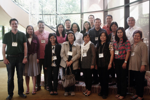
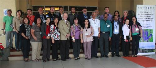
The first workshop day started with the welcome remarks from Nancy and Leni and introductions facilitated by Jocelyn Sta. Ana, OIC, Environmental Laboratory and Research Division, LLDA. Simon then gave an overview of IAN and environmental report cards, highlighting how it can effectively communicate the values and threats of Laguna de Bay. The four external experts each presented the results of their analysis of the 10-year data sets provided by LLDA covering the period 2004-2013, as well as recommend thresholds for their respective indicators. Dr. Jacinto presented the initial assessment of the different water quality indicators. It was apparent from the discussion following Dr. Jacinto’s presentation that setting the threshold for grading would be a great challenge.
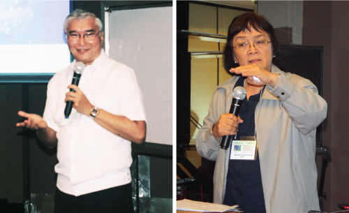
Dr. Macrina Tamayo-Zafaralla, Professor Emeritus, Institute of Biological Sciences, UP Los Banos, gave a presentation on cholorohyll-a and phytoplankton density as biological indicators, explaining the rationale, methodology and possible considerations in determining thresholds. Dr. Adelaida Palma, Chief, National Inland Fisheries Technology Center, Bureau of Fisheries and Aquatic Resources, presented the fisheries data. It was determined that the proportion of native against introduced/invasive species can be a good indicator. Dr. Rey Donne Papa, Assistant Professor, Department of Biological Sciences and Research Center for the Natural and Applied Sciences, University of Santo Thomas, presented the assessment of the zooplankton data. He highlighted that changes in zooplankton community can be used to indicate changes in the trophic state of the lake, level of eutrophication and warming history.

After the presentation of the four experts, Simon facilitated the discussion on determining the appropriate indicators and the scoring and grading system that will be used. Dave facilitated the discussion on the proposed framework of the report card including target audience, key messages, proposed solutions, good news stories, and identification of champions to facilitate communication of the report card.
Before the end of the first workshop day, I conducted an anonymous survey to collect each participants’ inputs and suggestions on the report card. This proved to be a fruitful endeavor as we were able to determine the group’s consensus on some of the points that were already discussed as well as get some new insights and recommendations. I presented the results of the survey and a mock-up version of the report card on the second day. One of the interesting recommendation was the use of the Filipino language, not just English, in the report card so that it can be better appreciated by the local fishermen, community members and stakeholders. For example, a slogan, quotation, or cartoon in Filipino that can effectively give the main theme/lesson of the report card can be included. It was already discussed on the first day that the first report card will be in English, and a translated version can be created later on.
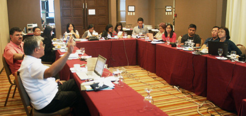
Simon and the four experts were able to calculate the initial scores and computed grades for the four sections of Laguna de Bay. Grades for the three indicators - water quality, biodiversity and fisheries were computed using 20% percentile from historical values as threshold. One of the challenges that came up was in justifying the grading system and in communicating the significance of the grades. Dave facilitated the action planning and next steps for the report card development, by setting a timeline for key activities and milestones. We are targeting to launch the report card during the 46th Anniversary of LLDA on October 22, 2015. This means that all of us - IAN-UMCES, LLDA, PRF and the external experts, have to work closely together to be able to meet this deadline.
There are still a lot of work and challenges ahead of us in the coming weeks - more data and information are still expected, the indicators and scores need to be reviewed, the report card framework has to be further developed, a stakeholder consultation needs to be conducted prior to finalization etc. However, the development of the first Laguna de Bay Environmental Health Report Card is just the first-step; the real challenge is in utilizing it in bringing people together to effect changes. The success of this project can be of great help to the future of Laguna de Bay; it can also serve as a framework for using environmental health report cards as a management tool in other important ecosystem in the Philippines in the future.
About the author
Vanessa Vargas-Nguyen

Dr. Vanessa Vargas-Nguyen is a Science Integrator with the Integration and Application Network and an associate faculty of the Marine Estuarine and Environmental Science Graduate Program. Her current interest is in transdisciplinary approaches, socio-environmental assessments, socio-environmental justice, stakeholder engagement, and adaptive environmental governance. Vanessa is originally from the Philippines and has extensive experience in molecular biology and marine science, specializing in microbial communities and molecular processes associated with Harmful Algal Blooms and shrimp, corals, and human diseases. She has since shifted her focus on how science can benefit society and was conferred with the first Ph.D. under the new Environment and Society foundation of the MEES graduate program. Her dissertation used ethnographic approaches to investigate the role of socio-environmental report cards in transdisciplinary collaboration and adaptive governance for a sustainable future. She received academic training from the University of the Philippines (BSc; MSc) and the University of Maryland (MSc; PhD). She is involved in developing holistic socio-environmental assessments for complex systems such as the Mississippi River and Chesapeake Bay watersheds and is coordinating a multi-year international transdisciplinary research consortium involving the US, Norway, Philippines, Japan, and India.

