In the Footsteps of Gengis Khan in the Mongolian Steppe: Part 2
Bill Dennison ·Downstream Tuul River
On the second day of field trips before our Tuul River report card workshop, we headed downstream to visit two mines: one recently built with a history of environmental protections, the other an old soviet mine with no apparent environmental regulation.
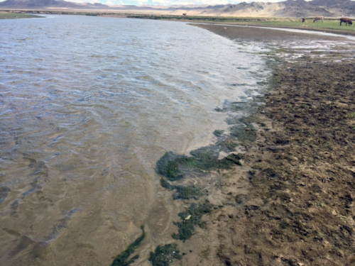
On our way, we passed out of the commercial downtown district of Ulaanbaatar, through the residential district with Soviet-built high-rise apartment buildings, and then into a commercial district with construction companies, scrap metal yards and light industry. By the time we reached the countryside, we could see a row of houses that had been constructed specifically for the heads of state who attended the Mongolia-hosted 2016 Asia-Europe Meeting. we made a stop at a bridge over the Tuul River to inspect it. Cattle wandered around the flood plain, and we could see tufts of wool from sheep that had grazed recently. Algal mats alongside the river banks demonstrated river eutrophication, or when an overabundance of nutrients create algal blooms, which in turn strip the river of its oxygen and block sunlight from the river bottom. There was some litter, primarily vodka bottles, as well.
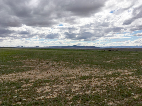
When we got back on the road we didn’t stay there long. During our eighteen-hour drive, our guide, Purevdorj Surenkhorloo from WWF Mongolia, nicknamed Puje, kept us on paved highways for about four hours. Then he veered off into the grassland. We bounced along rough tracks in the steppe and splashed through muddy puddles. The landscape was incredible. It was heavily grazed, the grass itself only a few inches high. I likened it to a gigantic golf course—just the fairway and greens, not the ‘rough’. This, and the incised stream beds from the flashy runoff generated from the steppe, are signs of overgrazing.
We saw some agriculture on the hillsides, but most of the land was used for livestock, as the overgrazed terrain suggested. The livestock herds typically had a mix of cows, sheep and goats. This livestock was smaller than North American livestock. The herds also often contained small horses, sometimes mounted by herders. We saw sheep sheared in pens, and, while on the road, large trucks bulging with wool. There were few fences; those that we noticed were near the city or tourist camps, where gers, or Mongolian yurts, used them to keep livestock out and provide privacy. There were a few dust devils swirling about the steppe and constant breezes.
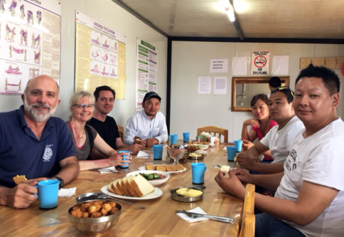
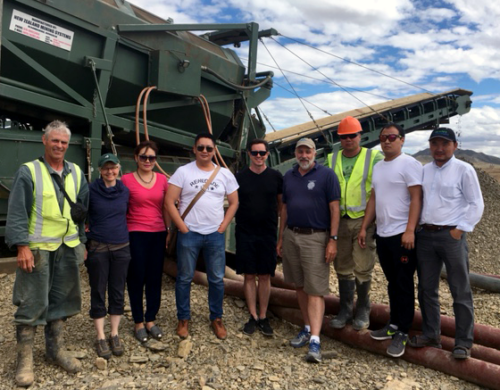
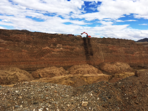
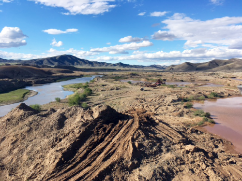
The first gold mine we visited was the Cold Gold Mongolia LLC. Danny Walker, a New Zealand miner who married a bright and engaging Mongolian woman, hosted a very tasty lunch a wonderful tour. The couple has been alluvial mining since the turn of the century. They showed us the large piles of gold-containing dirt that large excavators dumped into screeners. This was the first level of separation of gold from soil. These excavators and screeners work 24 hour days during the mid-April to November mining season. Danny also took us down into a fifty-foot deep mining hole, where we could see just how far they had to mine in order to reach this darker gold-rich soil. On a good week, the net gold obtained was about 5 kilos, which is a small amount considering all the dirt processed.
However, the most impressive part of our tour was the rehabilitation areas. The mining company sets aside the topsoil removed by excavations. When the gold from a mining hole has been fully gleaned, they fill it back up with the processed dirt. Afterwards, they spread this topsoil back over the surface of the hole. Water and fertilizer are applied and livestock fenced out. Once the grass is re-grown the fencing is removed and the livestock are allowed to graze. We saw these animals actively grazing eighteen-month old rehabilitation sites; a testament to the efficacy of this land rehabilitation.
Danny’s impressive environmental protections are an anomaly, however. He told us that out of approximately 42,000 half acres (ha) of mining licenses, run by 100 mining companies, only 6,000 ha have been rehabilitated. Unregulated mining is also an environmental concern. Unauthorized miners, called ‘Ninja Miners,’ will dig illegal holes and sneak onto mining leased areas, forcing the mining companies to hire security companies. The name Ninja Miner refers to the green bowls they use as gold pans. They wear these on their backs, which makes them resemble the Teenage Mutant Ninja Turtles. These miners continue their activities despite great risks: sometimes they get buried alive in their small mine shafts.
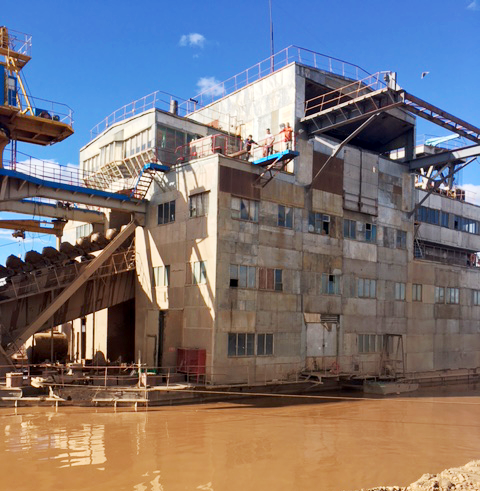
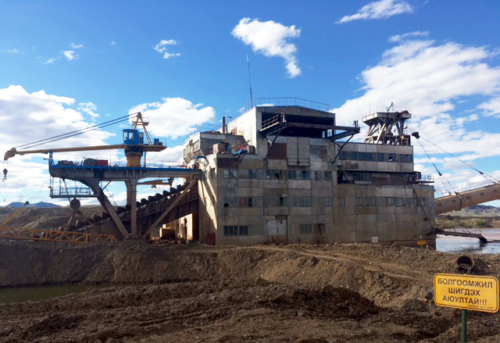
Our next mine visit also proved Danny’s point about the overall lack of environmental protections. At this site, a large floating Soviet-era dredge scooped up sediments and ran them through a cascading water flume to separate out the gold. The five active dredges made loud creaking sounds from rust and dilapidation. These dredges, combined with the surrounding disturbed soil, reminded me of a movie set such as for Mad Max or WaterWorld.
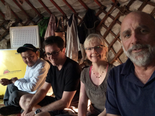
After this visit we stopped at a Mongolian ger and the owners offered us delicious yogurt. A ger has only one room, and a large extended family lived in it. This made us wonder how they dealt with personal privacy. The wide open steppe does not provide any shelter for toiletries, and the single room ensconced the living room, kitchen and bedroom. This family however, like others that live in gers, did have some modern conveniences, such as satellite dish televisions, motorcycles and pickup trucks.
The sun set as we left the ger and returned to Ulaanbaatar. Along the way, we saw demoiselle cranes with babies hopping along the river bed. Soon it was pitch black on the winding tracks through the steppe and then on the main road. The trip back was harrowing: horses and livestock wandered onto the road, and we had to avoid broken down cars and towed vehicles that loomed suddenly out of the darkness. By the time we reached our hotel it was 2:00 am.
The next day, Simon, Michele and I reflected on what we had seen in our two days of touring the Tuul River. From our observations we concluded that the Tuul River is heavily utilized and near its limit in water extraction. As we drove downstream, we could see the river shrink from overuse. This is especially concerning because there are no major tributaries feeding into the river. However, the countryside was stunningly beautiful, and it felt pleasing to see a river without impoundments or artificial levees and with an intact riparian zone. As always, having this first-hand experience of visiting the river and river users helps us when we conduct workshops and when we work with local experts. Puje made a great guide, and his ready smile and quick wit was a joy to be around.
About the author
Bill Dennison

Dr. Bill Dennison is a Professor of Marine Science and Vice President for Science Application at the University of Maryland Center for Environmental Science.

