Queenscliff, Bellarine peninsula and Victoria embayments
Bill Dennison ·At the invitation of Dr. Andy Longmore, Victoria Department of Primary Industries, Kate Moore and I traveled to Queenscliff on the Bellarine peninsula at the mouth of Port Phillip Bay. We stayed in a wonderful, cosy bed and breakfast in Queenscliff called the Athelstane House and worked in the Department of Primary Industries Queenscliff Centre with a variety of fisheries scientists.
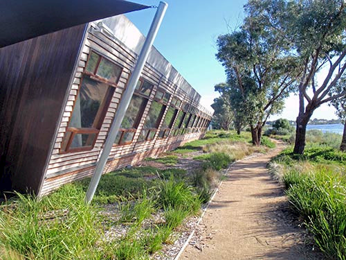
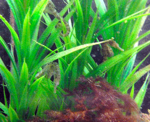
The Queenscliff Centre is an interesting facility with many energy efficient features including a green roof and slanting windows to obtain winter solar heat but to avoid summer heat. The location on Swan Bay overlooking seagrass meadows with wading birds and raptors was stunning. The ocean beach on Bass Strait is a short walk across the narrow peninsula, which has a nice heathlands, locally called the coastal Moonah woodland. Several people are able to commute to work via bicycle using the bike trail system. In addition to housing the Victoria Department of Primary Industries staff, there were facilities for university researchers and a small but well appointed Marine Science Centre with several aquaria containing local flora and fauna.


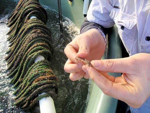
The Queenscliff Centre has a hatchery which is staffed by scientists from the shellfish industry as well as Department of Primary Industries staff. They showed us the blue mussel aquaculture facilities which included algal growth 'bags' to feed the larvae and outdoor tanks with ropes for the mussels to settle on. The seawater system uses clean water from Bass Strait.

One evening we joined the lab staff in a trivial pursuit game accompanied by beer and pizza. What I was particularly impressed with was the attendance of both junior and senior staff, and the amount of laughter that the incorrect answers generated. Apart from some questionable judging, it was a delightful evening.
We quickly learned that the Victorian scientists had good fisheries data and a wealth of various ecological data as well, including habitat and water quality data. They had focused their efforts on Port Phillip Bay, Western Port and Gippsland Lakes. They had a perspective that included climate change, fisheries and dredging.
Port Phillip Bay has been relatively well studied in a series of large, interdisciplinary scientific programs. The most recent large scale program was winding up, which was stimulated by a large channel dredging project near the mouth of Port Phillip Bay. The final report from a previous study conducted by CSIRO is an excellent synthesis, Port Phillip Bay environmental study : the findings 1992-1996.
We focused our efforts on science communication, running a session on Conceptionary and mocking up an environmental report card comparing the Victorian embayments; Port Phillip Bay, Western Port and Gippsland Lakes. The other major Victorian embayment is Corner Inlet, just east of Wilson's Promontory. This embayment is maintained in near pristine conditions due to a small watershed which is protected lands and excellent flushing with Bass Strait. The concept behind producing a science communication document collaboratively with DPI staff was to 'learn by doing', rather than focusing on science communication principles and theory. Andy Longmore set us up with key staff who provided shape files for maps, data for water quality, habitat maps and ecological data, photographs and synthesis text.

We heard about the conflict between commercial and recreational fishers and joked that Fisheries Victoria could adopt a version of the slogan 'Healthy Waterways: Because we're all in the same boat', which could be 'Victorian Fisheries: Because we all catch the same fish'.
One of the legacies from our Healthy Waterways program in Southeast Queensland was the appropriation of 'Healthy -----------' for a variety of programs. In Southeast Queensland, we called our fourth book 'Healthy waterways, healthy catchments : making the connection in south east Queensland, Australia'. A Natural Resource Management group in Southeast Queensland call themselves 'Healthy Country'. There is a flagship research program within CSIRO called 'Water for a Healthy Country'. Parks Victoria uses the slogan 'Healthy Parks, Healthy People'. I appreciate them making the connection between ecosystem health and public health and enjoy the healthy theme.
About the author
Bill Dennison

Dr. Bill Dennison is a Professor of Marine Science and Vice President for Science Application at the University of Maryland Center for Environmental Science.
Next Post > Brisbane 2011: Living with floods and dancing with dugongs
Comments
-
MARIANNE FERNANDEZ 8 years ago
Thank you for this article!
I have been in Wilson Promontory when I lived in Australia and it was an amazing experience! I visited a lot of places and did a website about it with some articles :)

