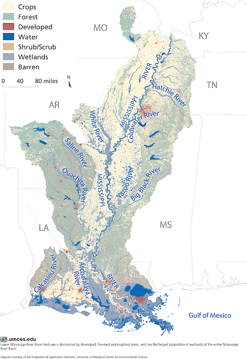
Lower Mississippi Land Cover Map
Lower Mississippi land use is dominated by developed, forested and cropland areas, and has the largest proportion of wetlands of the entire Mississippi River Basin.
diagram lower mississippi river land cover cropland forest developed wetlands| Author(s) | Jane Thomas |
| Author Company | Integration and Application Network |
| Date Created | 2014-06-05 |
| Album | Ecosystems > Maps |
| Type | Graphic |
| Publication | Lower Mississippi River Basin report card workshop newsletter |
| Project(s) | EcoCheck |
| Dimensions | 1006 x 1463 |
| Filesize | 1.2 MB |
| Number of Downloads | 378 |
| Filetype(s) | PNG |
| License | Attribution-ShareAlike 4.0 International (CC BY-SA 4.0) |
| Required Attribution | Jane Thomas, Integration and Application Network (ian.umces.edu/media-library) |

