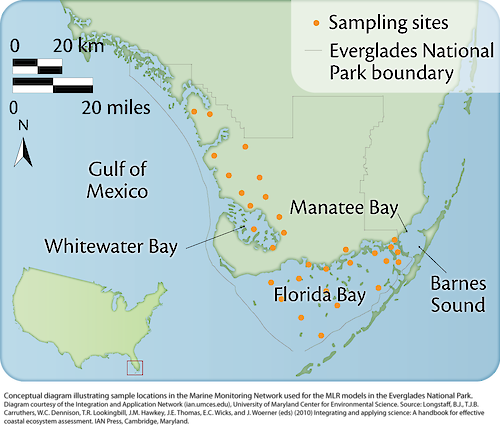
Sampling sites in the everglades
Conceptual diagram illustrating the sample locations in the Marine Monitoring Network used for the MLR models in the Everglades.
diagram everglades application communication model sampling mlr| Author(s) | Jane Thomas |
| Author Company | Integration and Application Network |
| Date Created | 2010-01-01 |
| Album | Human > Management/Restoration |
| Type | Graphic |
| Publication | Integrating and Applying Science: A handbook for effective coastal ecosystem assessment |
| Dimensions | 1000 x 849 |
| Filesize | 290.8 kB |
| Number of Downloads | 300 |
| Filetype(s) | PNG |
| License | Attribution-ShareAlike 4.0 International (CC BY-SA 4.0) |
| Required Attribution | Jane Thomas, Integration and Application Network (ian.umces.edu/media-library) |

