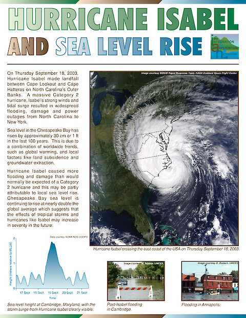
Hurricane Isabel and Sea Level Rise
This newsletter discusses the effects of sea level rise, land subsidence and ground water extraction on the flooding and damage caused by Hurricane Isabel. The damage caused by Hurricane Isabel was significantly worse than an unnamed hurricane of the same magnitude (category 2) in 1933. Sea level rise in Chesapeake Bay (30 cm / 1 ft in the last 100 years since the 1933 hurricane) is nearly double the global average suggesting that the effects of tropical storms and hurricanes may increase in severity in the future. Global sea level rise in the 20th Century is an order of magnitude higher than for the past several millenia. Chesapeake Bay islands are generally less than 1 m elevation, and many are suffering from erosion and submergence. Sharps Island is completely drowned, Poplar Island has lost more than 90% of its land, and Blackwater National Wildlife Refuge has lost around 2,000 hectares, or one-third of its total marsh area between 1938 and 19881. Erosion may also contribute to the decline of submersed aquatic vegetation (SAV), through an increase in water turbidity due to suspended sediments.
Keywords: