IAN is committed to producing practical, user-centered communications that foster a better understanding of science and enable readers to pursue new opportunities in research, education, and environmental problem-solving. Our publications synthesize scientific findings using effective science communication techniques.
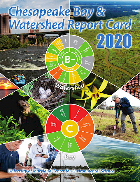
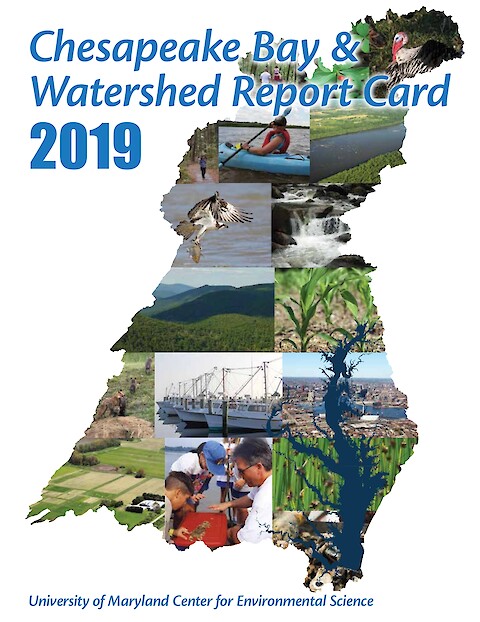
This report card provides a transparent, timely, and geographically detailed assessment of Chesapeake Bay. Since 2016, UMCES has engaged stakeholders throughout the watershed to transform the report card into an evaluation of the Chesapeake Watershed health. Watershed health includes traditional ecosystem indicators, but also social, economic, and cultural indicators. This is the second year the watershed has been scored, and four new indicators have been added.
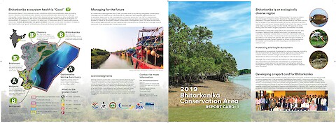
The National Centre for Sustainable Coastal Management (NCSCM), Ministry of Environment, Forest and Climate Change (MoEF&CC), jointly with the Odisha Forestry Sector Development Project (OFSDP-II) and the University of Maryland Center for Environmental Science, brought together over 40 local and regional experts and stakeholders in February 2019. Together the group chose ecosystem health indicators, thresholds and a reporting framework for Bhitarkanika Conservation Area.
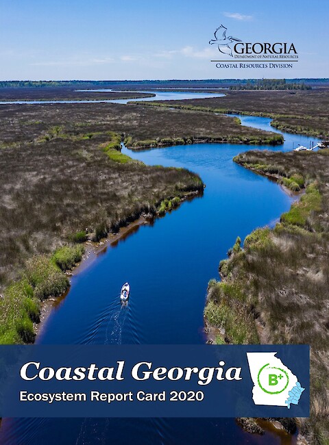
This is the seventh Coastal Georgia Ecosystem Report Card. Georgia DNR has been creating report cards since 2014, when IAN helped kick off the process. This report card updates indicators and methods. New indicators added were dissolved oxygen, spotted seatrout, and bald eagles. Overall, Coastal Georgia received a score of 77%, a B+.
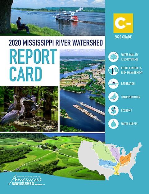
Kimberly Lutz, Frank Morton, Bob Beduhn, Joan Freitag, Stephen Gambrell, Steve Mathies, Dan Mecklenborg, Michael Reuter, David Simmons, Larry Weber (Chair), Heath Kelsey, Vanessa Vargas-Nguyen, Katie May Laumann, Steven Guinn, Sky Swanson, Jane Hawkey. and AWI Board of Directors: Kimberly Lutz, AWI Executive Director Bob Beduhn, HDR Inc. Sean Duffy Sr., Big River Coalition Joan C. Freitag, Hanson Professional Services Stephen Gambrell, Mississippi Valley Flood Control Association Teri Goodmann, City of Dubuque, Iowa Steve Mathies, Stantec Consulting Services Dan Mecklenborg, Ingram Barge Company Frank Morton, Turn Services LLC Rachel Orf, National Corn Growers Association Michael Reuter, The Nature Conservancy Rainy Shorey, Caterpillar, Inc. Robert “Bob” Sinkler, Streamside Systems Inc, and Dawson & Associates BG (Ret.) C. David Turner, American Water Military Services Group Kirsten Wallace, Upper Mississippi River Basin Association Larry Weber, University of Iowa ·
Stretching across 31 US states and 2 Canadian provinces, America’s Watershed benefits millions of people and thousands of communities. It supports our many economic activities while remaining a natural and recreational treasure of global importance.
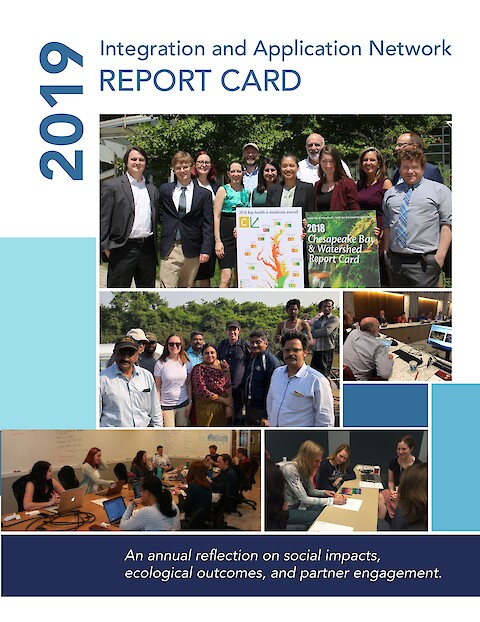
In the annual IAN Report Card, IAN staff reflect back on accomplishments from 2019. The self-assessment is based on indicators in three categories: social impacts, ecological outcomes, and partner engagement. Overall, IAN received an overall grade of B (84%) which is a slight decrease from the 2018 score of B (86%).
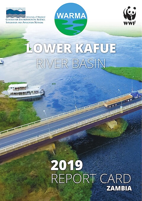
The first-ever Lower Kafue River Basin Report Card examines the health of the Kafue River in Zambia. Sixteen indicators in five categories were assessed across seven regions within the basin. The basin received a moderate score of 49, a C, illustrating that some regions of the basin are in better condition than others. This report card includes a detailed summary of the process and indicators as well as proposed management interventions and strategic actions to improve basin and river health.
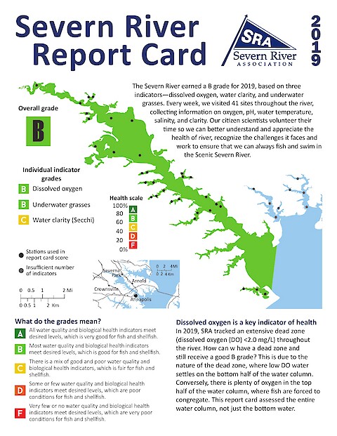
Published in 2020, the 2019 Severn River Report Card summarizes data collected in the summer of 2019. The Severn River earned a B in 2019, in part because of a "banner year" for underwater grasses. The coverage of underwater grasses in the Severn River more than doubled from 2018 to 2019, which is the greatest coverage seen in generations. The report card also provides recommendations for civilian action that can help improve the cleanliness of the river.
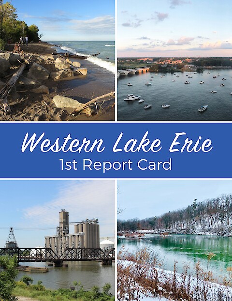
About one-third of the total population of the Great Lakes Basin lives within the Lake Erie Watershed. The lake provides drinking water for 11 million residents and is home to one of the largest freshwater commercial and recreational fisheries in the world. The lake and surrounding areas provide many recreational opportunities, such as camping, kayaking, boating, hiking, birding, and fishing, and are vital to the economy of the region.
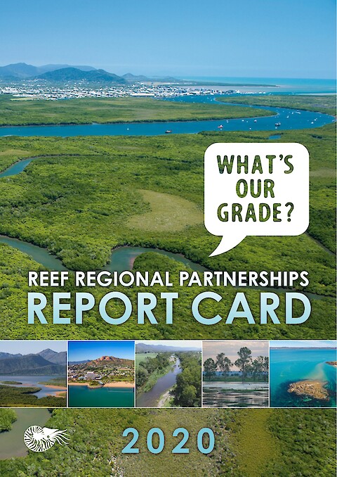
This assessment of the Office of the Great Barrier Reef in Queensland, Australia established five institutional goals: cohesive staff, credible science, resilient organization, relevance to stakeholders, and effective outreach. Each goal had its own set of indicators.
This report card provides a transparent, timely, and geographically detailed assessment of Chesapeake Bay. Since 2016, UMCES has engaged stakeholders throughout the watershed to transform the report card into an evaluation of the Chesapeake Watershed health. Watershed health includes traditional ecosystem indicators, but also social, economic, and cultural indicators. This is the first year the watershed has been scored, using five indicators of ecological and socioeconomic health.