

Initiating an assessment of Prince William Forest Park
Bill Dennison · | Environmental Report Cards |The IAN team (Simon Costanzo, Bill Dennison, Jane Thomas and Brianne Walsh) traveled to Prince William Forest Park for a workshop on 8 March 2013 with National Park Service staff. IAN is initiating a new series of Natural Resource Condition Assessments for the National Capital Region of the National Park Service. Previous assessments have been done by IAN for Rock Creek Park, Anteitam National Battlefield Park, Manassas National Battlefield Park, Monocacy National Battlefield Park, and Assateague Island National Seashore. In addition, we are in the final editing stages for Catoctin Mountain Park, Chesapeake and Ohio Canal National Historical Park, and Harpers Ferry National Historical Park assessments.
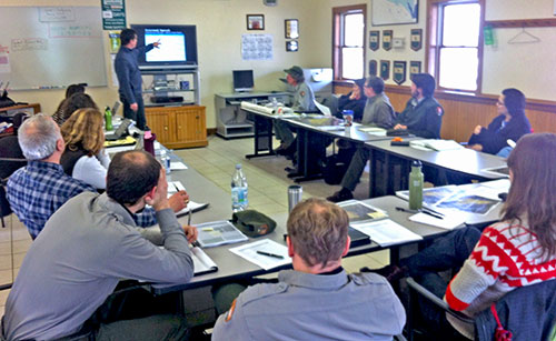
The workshop at Prince William Forest Park included National Park Service staff from the Inventory and Monitoring group based in Georgetown, Washington, D.C. and staff from Wolf Trap National Park for the Performing Arts. It was a cool, but sunny day and following the workshop, we were given a quick tour of Prince William Forest Park by Paul Petersen, the Chief of Natural Resources at Prince William Forest Park. Paul took us to see the North and South Forks of Quantico Creek that runs through the park, to the old pyrite mine site, and to some of the camps that were built by the Civilian Conservation Corps and the Works Progress Administration during the Great Depression. One of the camps also included buildings constructed during World War II by the Office of Strategic Services (precursor to the Central Intelligence Agency), who used the park for training.
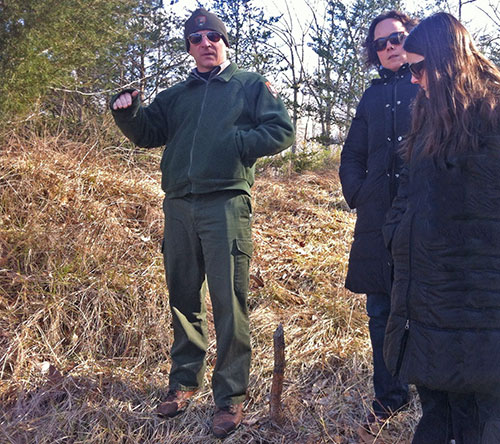

One of the things that we enjoy about working with the National Park Service staff is learning about iconic places from such knowledgeable people. They have a depth of knowledge about the natural and cultural resources and they are more than willing to share this knowledge. After looking at aerial photographs, maps and photographs, it was really nice to be able to see the park in person. There were no leaves on the trees with a light dusting of snow, allowing us to clearly see the topography and streams. We learned about the large intact forest in the park, freshwater sponges found in the streams, a rare pogonia plant, and issues like maintaining the natural soundscape. I look forward to visiting the park with foliage during the summer or autumn, but it was nice to get the broad overview now.
About the author
Bill Dennison

Dr. Bill Dennison is a Professor of Marine Science and Vice President for Science Application at the University of Maryland Center for Environmental Science.