Mission Aransas Pilot Project
Heath Kelsey · 
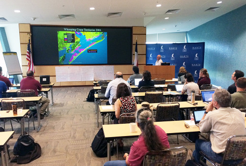
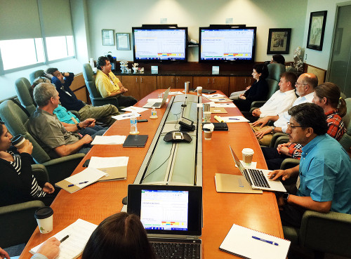
On April 27-28 I participated in another workshop related (indirectly) to the Texas Coast Report Card Pilot Project at Harte Research Institute in Corpus Christi Texas. This time, we were tasked with integrating human well being and ecosystem services into ecosystem health assessments and decision-making for the Mission Aransas National Estuarine Research Reserve (NERR). It was an interesting exercise, and gave me some ideas about how this could be done, and some pitfalls to avoid. This project hopefully will feed into the Texas Coast Report Card Project that Bill Dennison and I got involved in again last month. My reason for being at this current workshop was to remind people about how report cards work, and how this could eventually fit in to the project.

As often happens in other disciplines, it seems that the ecosystem services and ecosystem health folks have been working in relative isolation for quite a while. The groups seem to speak different languages, and think in different ways to arrive at decisions regarding natural resource management. So, at the very least, this exercise was a good reason for these two communities to work on something together.
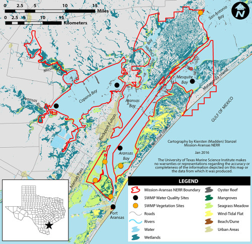
At issue in this meeting was the development of example scenarios representing outcomes for different options regarding a particular management question at the Mission Aransas NERR. We were reminded about the evolution of the DPSCR4 management framework being used in the Texas Pilot project. We also learned about the Mission Aransas NERR, and about how ecosystem services have been classified, and how they are now being translated into specific end user benefits, and then to measures of human well-being.

Of high interest is the protection of habitat for Whooping Crane, an endangered species that uses Mission Aransas (and nearby areas) as nesting areas. Although other issues were discussed, it was decided that marsh habitat for all colonial water birds was the overarching value that we would pursue in this exercise.
The first afternoon was spent really trying to figure out what the main issues were from the management perspective of the NERR, and how the process for assessing ecosystem services, and human well-being might work in this type of application. The example exercise we settled on was related to management colonial bird habitat management, under 4 different management scenarios, with the assumptions that there was desire to maintain or improve colonial water bird habitat under threat from erosion, sea level rise, predators, and coastal development, and that there was a limited budget to accomplish this task.

In the end, four management options (scenarios) were chosen for this exercise:
- Creation of a new marsh island from dredged material. This would be a simple island configuration that would provide new marsh habitat for colonial water birds.
- Creation of a new, multipurpose island from dredged material. This would not only provide new marsh habitat, but would be a complex of smaller islands with multiple habitats, including upland, beach, marsh, and shallow water areas with a range of depth.
- Protection, conservation, and remediation of existing marsh islands only, through renourishment, and shoreline protection.
- Simply changing the management strategies for existing marsh islands, such as increasing efforts to remove predators.

Of course each of these options would have different costs, as well as different benefits for habitat, resources that benefit from that habitat, specific human users that benefit from those resources, and, ultimately, human well-being effects that flow from those user benefits. After lots of discussion about how these effects flow from management decision to human well-being, we arrived at a general framework for how we might assist decision making.
This was an interesting exercise that may be useful in the context of illustrating linkages from ecosystem health protection and restoration through to real benefits and trade offs to different communities and users. This type of framework may be very useful as we progress toward the ability to define what "levers to pull" to change report card scores, and ultimately improve environmental condition for multiple human benefits. We're attempting to do this in our WWF partnership with a systems modeling approach that we call "Future Cards". We're also interested in doing this for the next phase of the Mississippi River Watershed Report Card partnership with America's Watershed Initiative.

I have to admit to being a skeptic of the approach in the beginning; it seems that although very detailed and specific Ecosystem Services and end users have been identified and classified, it still will require a good bit of work to carry the process through to evaluate human well being. Until late in the workshop, I saw limited utility in the tools, because to quantify human well-being effects with a high degree of confidence, it might take a multi-year (and multi million dollar) study to evaluate a host of decision scenarios at any location.
However, it is possible to approach the project in stages, similar to what we advocate for report cards, where we say it is important to get something done even if it is imperfect, then improve it in future versions. It is possible to identify, in a qualitative way, the linkages from decisions to habitat, resources, services, user benefits, and well being. First identify the pathways and direction, then qualitatively rank the strength of importance of those pathways, and finally estimate general effects. For example, you could reasonably say something like, "If you do this, it will likely have positive benefits for these habitats, resources and users, and negative impacts on these habitats, resources and users." If these choices can be viewed in the context of the cost of these options, it may provide a powerful tool to inform decision making. These benefits and human well-being effects can be quantified later, as time and budget allows.
I am curious to see if the systems modeling approach that we are using in our WWF partnership and the classification of services and users can be used together.
About the author
Heath Kelsey

Heath Kelsey has been with IAN since 2009, as a Science Integrator, Program Manager, and as Director since 2019. His work focuses on helping communities become more engaged in socio-environmental decision making. He has over 10-years of experience in stakeholder engagement, environmental and public health assessment, indicator development, and science communication. He has led numerous ecosystem health and socio-environmental health report card projects globally, in Australia, India, the South Pacific, Africa, and throughout the US. Dr. Kelsey received his MSPH (2000) and PhD (2006) from The University of South Carolina Arnold School of Public Health. He is a graduate of St Mary’s College of Maryland (1988). He was also a Peace Corps Volunteer in Papua New Guinea from 1995-1998.

