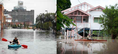
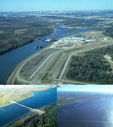
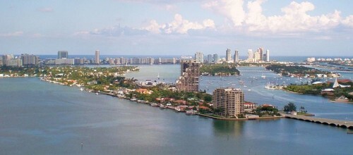
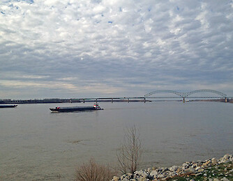
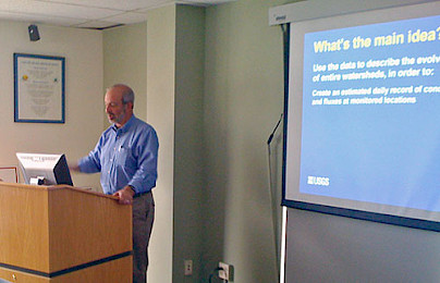
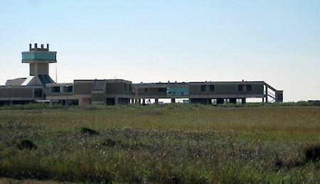
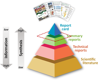
Join the Celebration!


Celebrating 100 Years of Science! | 1925-2025

  • UMCES HOME
  • DONATE

Search form

  • Work with Us
    • Science communication services
    • Environmental report card production
    • Training and capacity building
    • Stakeholder Engagement
    • Careers
  • Media Library
    • Symbols
    • Graphics
    • Photos
    • Videos
  • Report cards
  • Education
    • Professional Certificate
    • MEES Graduate Program
    • Short Courses
    • Initiatives
  • Blog
  • Enewsletter
  • Publications
    • Books
    • Report Cards
    • Newsletters
    • Reports
    • Brochures
    • Posters
    • Papers
  • Projects
  • About
    • Who we are
    • What we do
    • Our Mission
    • History
    • Partnerships
    • Contact
    • Land Acknowledgment Statement
    • Project Videos
  • Home
  • Search
  • All
  • People
  • Publications
  • Media Library
  • Blog Posts
  • Enewsletter Articles
  • Projects
  • Pages
  • All results

    198 results for "Mississippi":

    • Louisiana Sea Grant Discovery, Integration and Application initiative (LA DIA)
      .... Amy Clipp played the part of a Vietnamese fisher (Sally Dang) who was concerned that Jacob Mitchell's depictions of Mississippi River sediment diversions would affect the livelihoods of her family and community. Matt Bethel played the part of a...
    • Land use map of the Missouri River basin
      ...ri River basin ... This map depicts land use in the Missouri River sub-basin, one of the five major sub-basins of the Mississippi River. ... diagram, Missouri, Mississippi, crops, forest, developed, water, shrub, scrub, wetlands, barren, Midwest,...
    • Land use in the Arkansas River and Red River sub-basin
      ... ... This map depicts land use in the Arkansas River and Red River sub-basin, one of the five major sub-basins of the Mississippi River. ... diagram, Arkansas River, Red River, Mississippi, crops, forest, developed, water, shrub, scrub, wetlands,...
    • Potential indicators for the Arkansas River and Red River sub-basin
      ... depicts potential indicators for the Arkansas River and Red River sub-basin, one of the five major sub-basins of the Mississippi River. ... diagram, Arkansas River, Red River, Mississippi, economy, recreation, transportation, water supply, flood...
    • Conceptual diagram showing features and threats of the Arkansas River and Red River sub-basin
      ... main threats and key features of the Arkansas River and Red River sub-basin, one of the five major sub-basins of the Mississippi River. ... diagram, Arkansas River, Red River, Mississippi, Midwest, river, basin ... Jane Thomas...
    • Conceptual diagram showing features and threats of the Missouri River sub-basin
      ...llustrates the main threats and key features of the Missouri River sub-basin, one of the five major sub-basins of the Mississippi River. ... diagram, Missouri, Mississippi, Midwest, river, basin ... Jane Thomas...
    • The CEER Conference provides insight to the future of report cards
      ...from July 28 to August 1, 2014. I presented on our Alex Fries at the UMCES booth CEER Conference a good venue for the Mississippi Report Card There could not have been a more appropriate location to talk about a report card for the Mississippi Riv...
    • Kicking off the Louisiana Discovery Integration and Application program in Baton Rouge
      ...to develop visualizations for sediment diversions. Sediment diversions are the redirection of some of the flow of the Mississippi River into areas where the river-bourne sediments will settle and help create wetlands and land. Sediment diversions...
    • Arkansas River and Red River Basins report card workshop newsletter
      ...be convened in each of the four remaining sub-basins and results will be integrated into a report card for the entire Mississippi River Basin. ... Bill Dennison ... Heath Kelsey ... Jane Thomas ... Caroline Donovan ... Bill Nuttle...
    • National Monitoring Conference in Cincinnati, Ohio
      ... session in which I moderated part one and gave a talk in part two. My talk focused on report cards, specifically the Mississippi River Report Card (America’s Watershed Initiative) and the Rookery Bay Report Card as examples of calculating w...
    • Main Threats and Key Features of the Ohio River Basin
      ...d-workshop-newsletter/ ... diagram, Ohio, river, basin, threats, features, issues, geology, development, agriculture, Mississippi ... Jane Thomas...
    • Ohio River Basin Land Use
      ...asin-report-card-workshop-newsletter/ ... diagram, map, Ohio, river, basin, land, use, developed, forested, cropland, Mississippi ... Jane Thomas...
    • Main Threats and Key Features of the Upper Mississippi River Sub-Basin
      Main Threats and Key Features of the Upper Mississippi River Sub-Basin ... A conceptual diagram illustrates the main threats and key features of the Upper-Mississippi River...
    • Flow Capacity for the Mississippi River
      Flow Capacity for the Mississippi River ... A diagram illustrates the flow capacity for the Mississippi River in thousands of cubic feet per second, based on the 1956 project design flood. The Ohio river is the 200,000 sq...
    • Oklahoma report card song
      Oklahoma report card song ... As part of the Mississippi River report card process, we held a workshop at the Mayo Hotel in Tulsa , Oklahoma to discuss the Arkansas and Red R...
    • Threats and Features of the Lower Mississippi River Basin
      Threats and Features of the Lower Mississippi River Basin ... The Lower Mississippi River Basin supports a diversity of uses, dependent upon both natural and human engineered systems. This conceptual d...
    • Mississippi River Report Card Workshop Timeline
      Mississippi River Report Card Workshop Timeline ... A conceptual diagram illustrates the dates and locations of different Mississ...
    • Potential Indicators for the Ohio River Basin
      ...tential, indicators, transportation, water, supply, flood, control, risk, reduction, economy, ecosystems, recreation, Mississippi ... Jane Thomas...
    • Lower Mississippi Workshop Connections
      Lower Mississippi Workshop Connections ... Several connections were made at the Lower Mississippi River Basin workshops. These connections will be used to develop a basin-wide report card for the watershed. ... diag...
    • Lower Mississippi Land Cover Map
      Lower Mississippi Land Cover Map ... Lower Mississippi land use is dominated by developed, forested and cropland areas, and has the largest proportion of wetlands of the en...
    • The 2014 River Rally in Pittsburgh
      ...e, part of Fort Pitt, is thought to be the oldest (1764) building still standing in Pittsburgh and perhaps the entire Mississippi basin. I stayed in a 98 year old hotel, the Omni William Penn Hotel , which was elegant and very nice. Fort Pitt bloc...
    • Missouri River: Environmental Literacy
      ...principles for the Missouri River are the following: The Missouri River is the longest tributary (2,300 miles) of the Mississippi River. Navigation on the Missouri River is supported by a series of levees and dikes from the mouth to Sioux City, Io...
    • Upper Mississippi River: Environmental Literacy
      Upper Mississippi River: Environmental Literacy ... ' Environmental literacy ' series The seven environmental literacy principles for t...
    • Visiting the Nickel Preserve in eastern Oklahoma
      ...to the Arkansas/Red River workshop in Tulsa , OK where we facilitated a workshop associated with the development of a Mississippi River report card , five of us traveled to The Nature Conservancy (TNC) Nickel Preserve in Eastern Oklahoma. Jordy Jo...
    • Lower Mississippi River Basin report card workshop newsletter
      Lower Mississippi River Basin report card workshop newsletter ... The America's Watershed Initiative Report Card project continued with...
    • Prev
    • 1
    • 2
    • 3
    • 4
    • 5
    • 6
    • 7
    • 8
    • Next

UMCES Links

  • Home
  • About
  • Campuses
  • News & Events
  • Directory
  • Employment
  • Research
  • Press Room

Contact Info

2020 Horns Point Rd
Cambridge, MD 21613

410-221-2048

Contact

Enewsletter

Subscribe to our enewsletter

Copyright 2025 UMCES | Privacy/Terms of Use | An Institution of the University System of Maryland