IAN is committed to producing practical, user-centered communications that foster a better understanding of science and enable readers to pursue new opportunities in research, education, and environmental problem-solving. Our publications synthesize scientific findings using effective science communication techniques.
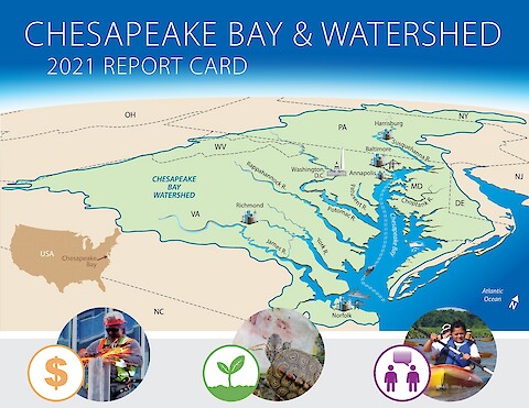
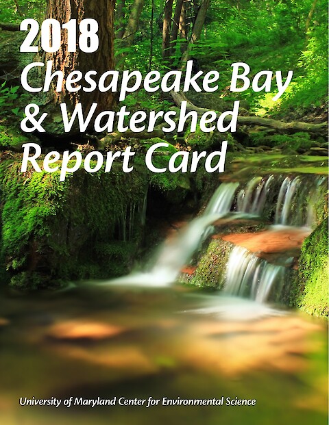
This report card provides a transparent, timely, and geographically detailed assessment of Chesapeake Bay and its Watershed. Since 2016, UMCES has engaged stakeholders throughout the watershed to transform the report card into an evaluation of the Chesapeake Watershed health. Watershed health includes traditional ecological indicators, but also economic and societal indicators. This is the third year the watershed has been scored, and four new economic indicators have been added.
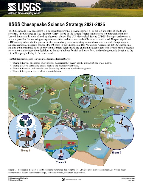
The Chesapeake Bay ecosystem is a national treasure that provides almost $100 billion annually of goods and services. The Chesapeake Bay Program (CBP), is one of the largest federal-state restoration partnerships in the United States and is underpinned by rigorous science. The U.S. Geological Survey (USGS) has a pivotal role as a science provider for assessing ecosystem condition and response in the Chesapeake watershed.
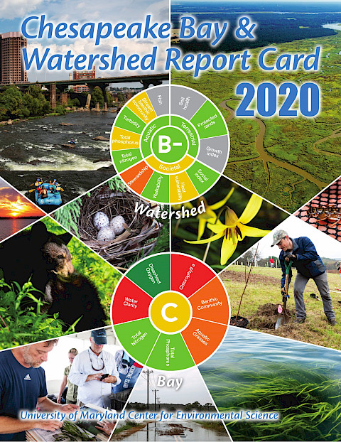
This report card provides a transparent, timely, and geographically detailed assessment of Chesapeake Bay. Since 2016, UMCES has engaged stakeholders throughout the watershed to transform the report card into an evaluation of the Chesapeake Watershed health. Watershed health includes traditional ecosystem indicators, but also social, economic, and cultural indicators. This is the second year the watershed has been scored, and four new indicators have been added.
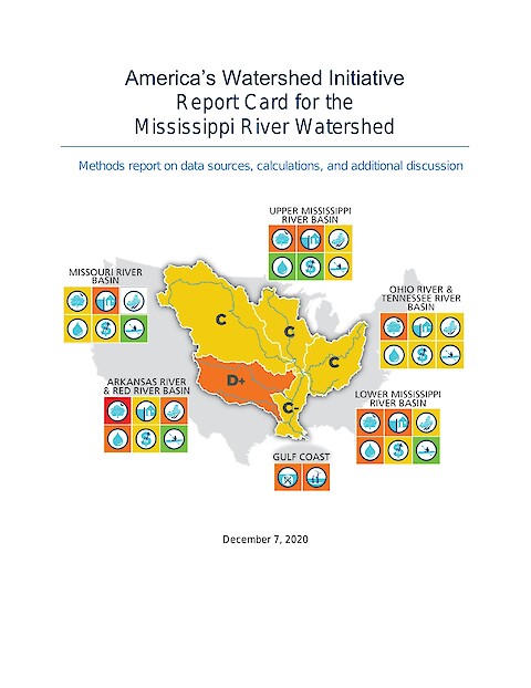
This companion document to the 2020 Mississippi River report card contains information about data sources for all indicators, summary of analysis methods, and scoring details for each of the six America’s Watershed Initiative goals, and for two watershed wide indicators. Additional information regarding the goals is included to provide greater detail and discussion than is possible in the report card document.
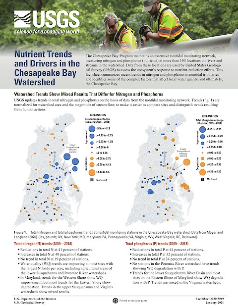
The Chesapeake Bay Program maintains an extensive nontidal monitoring network, measuring nitrogen and phosphorus (nutrients) at more than 100 locations on rivers and streams in the watershed. Data from these locations are used by USGS to assess the ecosystem’s response to nutrient-reduction efforts.
Kimberly Lutz, Frank Morton, Bob Beduhn, Joan Freitag, Stephen Gambrell, Steve Mathies, Dan Mecklenborg, Michael Reuter, David Simmons, Larry Weber (Chair), Heath Kelsey, Vanessa Vargas-Nguyen, Katie May Laumann, Steven Guinn, Sky Swanson, Jane Hawkey. and AWI Board of Directors: Kimberly Lutz, AWI Executive Director Bob Beduhn, HDR Inc. Sean Duffy Sr., Big River Coalition Joan C. Freitag, Hanson Professional Services Stephen Gambrell, Mississippi Valley Flood Control Association Teri Goodmann, City of Dubuque, Iowa Steve Mathies, Stantec Consulting Services Dan Mecklenborg, Ingram Barge Company Frank Morton, Turn Services LLC Rachel Orf, National Corn Growers Association Michael Reuter, The Nature Conservancy Rainy Shorey, Caterpillar, Inc. Robert “Bob” Sinkler, Streamside Systems Inc, and Dawson & Associates BG (Ret.) C. David Turner, American Water Military Services Group Kirsten Wallace, Upper Mississippi River Basin Association Larry Weber, University of Iowa ·
Stretching across 31 US states and 2 Canadian provinces, America’s Watershed benefits millions of people and thousands of communities. It supports our many economic activities while remaining a natural and recreational treasure of global importance.
The Evaluating Transdisciplinary Approaches Workshop was convened by the Belmont Forum at the National Science Foundation and facilitated by the University of Maryland Center for Environmental Science in Alexandria, VA, USA on 26–28 June 2019. Participants of the workshop are part of a growing community of transdisciplinary research supporters and practitioners. Their efforts contribute to our fundamental and applied understanding of complex systems.
This report card provides a transparent, timely, and geographically detailed assessment of Chesapeake Bay. Since 2016, UMCES has engaged stakeholders throughout the watershed to transform the report card into an evaluation of the Chesapeake Watershed health. Watershed health includes traditional ecosystem indicators, but also social, economic, and cultural indicators. This is the first year the watershed has been scored, using five indicators of ecological and socioeconomic health.
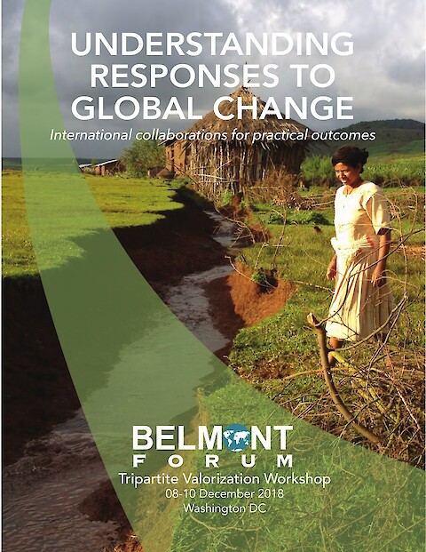
The Tripartite Valorization Workshop was convened by the Belmont Forum and facilitated by the University of Maryland Center for Environmental Science in Washington DC on 8-10 December 2018. It served as the-end term meeting for the Food Security and Land Use Change Collaborative Research Action (CRA), and mid-term meetings for the Arctic Observing and Science for Sustainability and Mountains as Sentinels of Change CRAs.
This report card provides a transparent, timely, and geographically detailed assessment of Chesapeake Bay. In 2018, the report card includes five water quality indicators and two biotic indicators. In 2018, the overall grade for Chesapeake Bay is a 46%, a C. This means the Bay is in moderate health. Despite the decrease in score from 2017, overall bay health is still significantly improving over time. Long term trends of each reporting region health and a fisheries index are also presented.